2014-May-05
EarthServer at the EGU General Assembly in Vienna
EarthServer at the EGU General Assembly in Vienna
The European Geosciences Union is dedicated to the pursuit of excellence in the geosciences and the planetary and space sciences for the benefit of humanity.
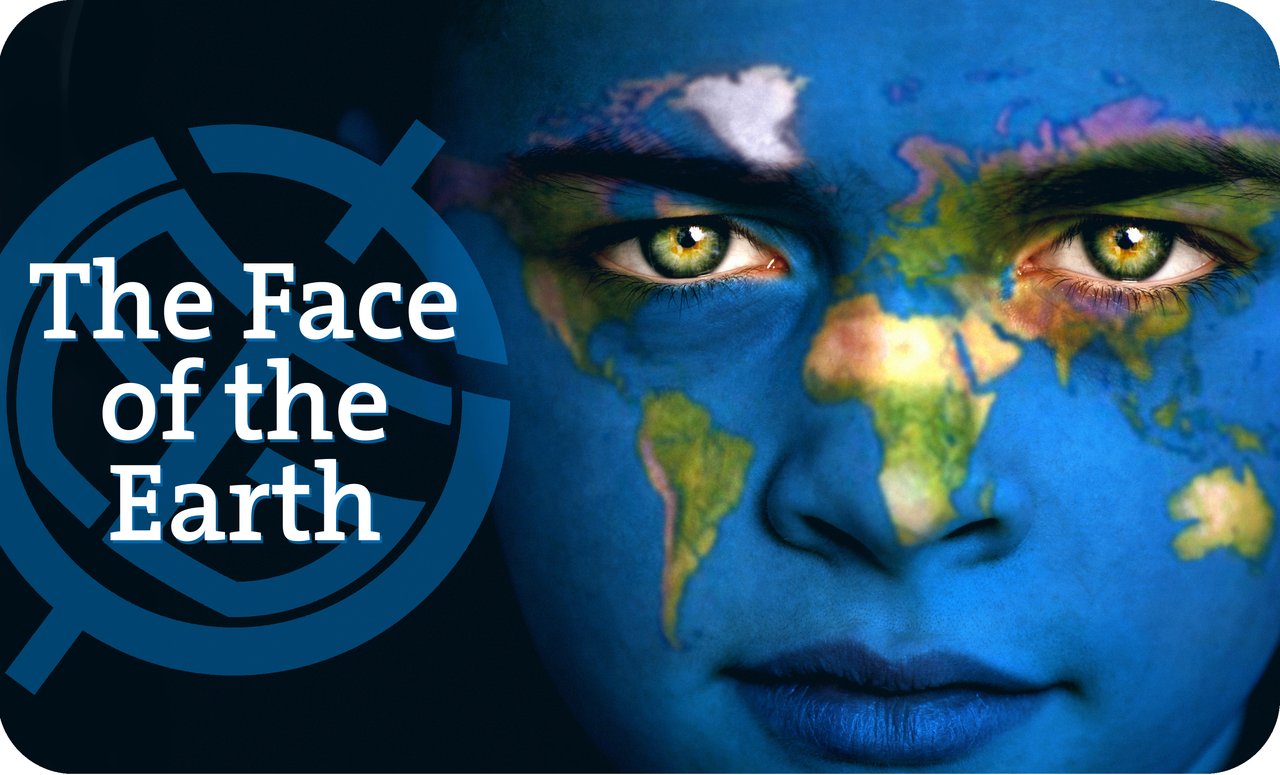
The annual EGU General Assembly is the largest and most prominent European geosciences event. The EGU General Assembly 2014 was held in Vienna on 27 April - 2 May with the theme "The Face of the Earth". It was a great success with 4,829 oral, 9,583 poster, and 483 PICO presentations. 568 unique scientific sessions together with 126 Poster Summaries and Discussions as well as 245 side events created an interesting programme. At the conference 12,437 scientists from 106 countries participated, of which 27% were students.
EarthServer participated with several oral presentations, posters and live demos illustrating the full range of on-going activities in the project:
- Peter Baumann, "Bringing Ad-Hoc Analytics to Big Earth Data: the EarthServer Experience" (Oral presentation)
- Alireza Rezaei Mahdiraji and Peter Peter Baumann, "Toward An Unstructured Mesh Database" (Poster)
- Risav karna, "Unified Access Architecture for Large-Scale Scientific Datasets" (Poster presentation)
- Dimitar Misev, Johannes Bachhuber, and Peter Baumann, "Integrating Scientific Array Processing into Standard SQL" (Poster)
- Alan Beccati, Peter Baumann, "Multi-Disciplinary Data Services: Standards-based Coverage Services Fostering Integration; The EarhServer approach" (Oral presentation)
- Simone Mantovani, Stefano Natali, Damiano Barboni, Mario Cavicchi, and Andrea Della Vecchia, "Data Curation for the Exploitation of Large Earth Observation Products Databases - The MEA system" (Oral presentation)
- Stefano Natali, Simone Mantovani, Marco Folegani, and Damiano Barboni, "Multi-sensor Evolution Analysis system: how WCS/WCPS technology supports real time exploitation of geospatial data"(Poster)
- Roberto Barbera, Riccardo Bruno, Antonio Calanducci, Marco Fargetta, Marco Pappalardo, and Francesco Rundo, "Earth science big data at users' fingertips: the EarthServer Science Gateway Mobile" (Oral presentation)
- John Laxton, Marcus Sen, and James Passmore "The EarthServer Geology Service: web coverage services for geosciences" (Poster)
- Peter Baumann, "Big Data Standards in Action: Spatio-Temporal Analytics with EarthServer" (Poster presentation)
- Federico Cantini, Angelo Pio Rossi, Roberto Orosei, Peter Baumann, Dimitar Misev, Jelmer Oosthoek, Alan Beccati, Piero Campalani, and Vikram Unnithan "MARSIS data and simulation exploited using array databases: PlanetServer/EarthServer for sounding radars" (Poster)
- Angelo Pio Rossi, Jelmer Oosthoek, Peter Baumann, Alan Beccati, Federico Cantini, Dimitar Misev, Roberto Orosei, Jessica Flahaut, Piero Campalani, and Vikram Unnithan, "PlanetServer/EarthServer: Big Data analytics in Planetary Science" (Poster)
- Oliver Clements and Peter Walker, "Can EO afford big data - an assessment of the temporal and monetary costs of existing and emerging big data workflows" (Oral presentation)
- Simone Mantovani, Stefano Natali, Marco Folegani, and Alessandro Scremin, "Intensive time series data exploitation: the Multi-sensor Evolution Analysis (MEA) platform" (Poster)
- Sebastian Wagner, Pasquale Herzig, Ulrich Bockholt, Yvonne Jung, and Johannes Behr "EarthServer - 3D Visualization on the Web" (Oral presentation)
A Splinter Meeting was held on the topic "Big Data Analytics for Earth Science: the EarthServer approach". About 30 researchers from all around the world attended it providing a valuable contribution to the open discussion.
More information: http://www.egu2014.eu/
2013-Nov-15
EarthServer Climate Data Service integrated at the European Space Agency
EarthServer Climate Data Service integrated at the European Space Agency
On November 15th 2013, the EarthServer Climate Data Service has been successfully integrated at the European Space Agency: a powerful hardware infrastructure consisting of 40CPUs and 120GB RAM hosts the subsystems to handle EO products and model data.
Atmosphere and Climate products collected within the EarthServer project (http://www.earthserver.eu) as well as EO products provided by the European Space Agency, are presently accessible through the Multi-sensor Evolution Analysis (MEA) platform. The detailed list of EO products and model data is available at https://mea.eo.esa.int/data_availability.html
Single Sign On (SSO) technology is used to authenticate and login in to the MEA system.
MEA provides to users the following functionalities:
- Real time data access and visualization (time series display)
- Data comparison (e.g. same variable from different data sources)
- On-the-fly data analysis (extraction of statistical parameters)
2013-Oct-01
EarthServer at the OGC TC Meeting
EarthServer at the OGC TC Meeting
FOSS4G is the annual gathering of Open Source Geospatial Developers, Users and Leaders. FOSS4G 2013 was held in Nottingham from 17th to 21th of September.
EarthServer presented some outcomes. In particular EOX gave two presentations on "WCS & EO-WCS Status in Open Source" and "ESA User Services powered by Open Source". BGS gave a presentation on "Opening Up Access To Geological Data With Rasdaman Based WCS And WCPS Services".
2013-Oct-01
EarthServer at the OGC TC Meeting
EarthServer at the OGC TC Meeting
At the end of September the Open Geospatial Consortium (OGC) held its 86th Technical Committee (TC) meeting at the European Space Agency (ESA) in Frascati near Rome, Italy. Standardization in the Geospatial domain is of high importance particularly in Europe as the number of 180 registered participants suggests. Consequently the agenda for the four day meeting was quite packed with four parallel sessions running for nine hours each day.
EarthServer members contributed to and presented their work in a number of sessions. In particular:
Stephan Meissl (EOX) co-chaired the Coverages.DWG and WCS.SWG working groups. The ideas are generally well received and progress could be made in a number of topics like WCS format encoding extensions, irregular grids, or CRS definitions. Stefano Nativi (CNR) co-chaired the CF-netCDF SWG presenting the conceptual mapping of the CF-netCDF data model to address data access services. The approach was approved and a first action on the CF-netCDF encoding in GML 3.2 has been decided.
2013-Sep-26
EarthServer 3D client presented on the X3DOM site

EarthServer 3D client presented on the X3DOM site
On the 23rd of September the X3DOM site published a news entry about the EarthServer project and its activities on building 3d web tools by using the X3DOM technology.
More information: http://www.x3dom.org/
2013-Sep-13
Climate Data Service presented at the ESA Living Planet Symposium in Edinburgh
"The Multi-sensor Evolution Analysis (MEA) and the Climate Data Service platforms have been presented during the ESA Living Planet Symposium (Edinburgh, September 09-13) as the reference implementation for accessing land and atmosphere products via WCS/WCPS technology."
More information:
http://www.livingplanet2013.org
2013-Ago-23
Rasdaman inventor now OSGeo Charter Member
Bremen, August 2013. Peter Baumann, Professor of Computer Science, has been elected Charter Member of OSGeo.
The Open Source Geospatial Foundation, or OSGeo, is a not-for-profit organization whose mission is to support the collaborative development of open source geospatial software, and promote its widespread use. OSGeo also serves as an outreach and advocacy organization for the open source geospatial community, and provides a common forum and shared infrastructure for improving cross-project collaboration.
"It is an exciting opportunity to support the open source idea in all its variety", says Peter Baumann and explains, "Not only do the Charter Members elect the Board of Directors, but they also actively contribute in discussion." Baumann is well known in OSGeo circles with the Big Data Analytics engine, rasdaman, which is jointly developed by Jacobs University and rasdaman GmbH, a research spinoff. Research around rasdaman has pioneered the area of Array Databases, which is seen as a key Big Data technology by major database vendors. Further, Baumann is editor of international standards in the field and chair of several standards working groups.
More information:
http://www.osgeo.org
http://en.wikipedia.org/wiki/Rasdaman
http://en.wikipedia.org/wiki/Array_DBMS
2013-Ago-20
OGC Progressing with Function-Rich Big Data Standards
August 20, 2013. Yesterday voting on the new OGC standard for Coordinate System handling of spatio-temporal data sets has finished with all YES votes. This extends the OGC Web Coverage Service (WCS) suite, together with several further specifications submitted earlier which are disclosed for public commenting. Together, this makes WCS Swiss Army Knife for big and small coverage data, such as sensor data, raster images, timeseries, point clouds, and meshes.
Among the supporters of the new "OGC WCS Extension - CRS" with OGC document number 11-053 are US NOAA and USGS, German AdV, French BRGM and METEO-FRANCE, Australian CSIRO, the European Union Stellite Centre, Oracle, and EADS. "This new standard closes an important gap, as for the first time it allows to treat spatial and temporal coordinates alike" explains Peter Baumann from Jacobs University, the editor of the specification, and details "this will tremendously ease access to and analysis of satellite image timeseries and weather data, for example".
Prior to voting on the adoption of a standard, as with WCS CRS, OGC mandates a public Request for Comment period where the candidate standard is made available to the public and comments are sought. The document editors duly consider all comments, and the revised version goes into voting.
In case of WCS, several further specifications are in this pipeline: WCS Range Subsetting, which allows to extract channels from hyperspectral images or multi-variable climate data sets; WCS Processing, which establishes a bridget between the simple data access protocol of WCS and the advanced filtering and processing query language of the Web Coverage Processing Service (WCPS); WCS Scaling, which allows clients to get downscaled data sets with reduced resolution, such as for Web browser display and thumbnails; WCS Interpolation, which gives clients fine-grain control over any interpolation the server performs during its processing.
A RESTful protocol binding for WCS is in progress by the OGC WCS Standards Working Group and will likely be rolled out soon as well.
"The team has worked hard over the last few years, and now we are reaping the benefits - WCS is the most powerful, comprehensive Big Earth Data service suite available" says Peter Baumann. "Not the least because we have harmonized it across OGC, so that coverages can be exchanged freely between WFS, WCS, WCPS, WPS, and SOS."
http://external.opengeospatial.org/twiki_public/CoveragesDWG/WebHome
2013-Jun-30
Big Data from Space... directly to the Users
Frascati, 12 June 2013. How can we make the large amounts of Earth observation data accessible to a wider user community? To explore this idea, some 250 science, industry and policy-making representatives and national delegates from Europe, the US, Australia, China, and Africa met at ESA's ESRIN space centre in Frascati, Italy for ESA's first "Big Data from Space" event.
Data from Earth observing satellites and other remote sensing technologies are growing in volume and diversity at an exceptionally fast rate. This poses challenges and opportunities for their quick access, stewardship and applications.
Peter Baumann was invited to present Jacobs University's research on flexible, scalable search and processing on huge data archives, Overall, more than 50 presentations during the three-day conference stimulated discussion between the different communities involved in the business of providing and manipulating very large-scale data and complex analyses of satellite and in situ Earth observations.
Diversity of space data, the combined use of data from different space missions and the fusion of satellite data with non-space data lead to new types of user applications. This affects the way such data are collected, processed, delivered and preserved. There is an increasing need to serve a wider user community looking to retrieve simple, understandable and immediate information from remotely sensed data that have undergone complex processes and analyses.
Given the overwhelming success of the event, ESA is now considering whether this can become a recurring event.
2013-Jun-29
INSPIRE Conference in Florence

The aim of this year's INSPIRE Conference (INSPIRE 2013: The Green Renaissance) was to further exchange views and experiences on how INSPIRE is meeting past and emerging challenges and needs. To identify new opportunities and to finally, reflect collectively on how INSPIRE can further evolve to maximise its benefits for society.
Alan Beccati (Jacobs University of Bremen) gave a talk about "WCS as a Download Service for Big (and Small) Data" presenting some relevant outcomes of the EarthServer project.
More information: http://inspire.jrc.ec.europa.eu/events/conferences/inspire_2013/
2013-Jun-15
Cloud support available with open-source rasdaman
Bremen, May 24, 2013: The new release of open-source rasdaman 8.4.2 supports fully transparent distribution of query workloads across a network. Nodes can join and leave the network at any time, allowing the cloud or cluster to adjust traffic and grow and shrink dynamically.
"Rasdaman now seamlessly scales from laptop to cloud and clusters", says Dr. Peter Baumann, CEO and Professor at Jacobs University. "But we are already going beyond this, preparing dynamic query splitting for the next version".
Security is an important aspect of such federated processing. Accessibility administration ranges from centralized control of the whole cloud to single-node access rules. This way, control remains fully with the administrator of each node.
The open-source rasdaman project is led by Jacobs University, Bremen in collaboration with the research spin-off, rasdaman GmbH, which also offers proprietary rasdaman enterprise. Data archives and producers worldwide like Deutscher Wetterdienst (German Metoffice), NASA, and Vito / Belgium are using rasdaman.
http://www.rasdaman.org/
2013-Jun-15
OGC RESTful Big Data API Published
Geo services typically have to deal with Big Data when hosting sensor, image, simulation, and statistics data. Now the elegant RESTful API style is becoming reality with the Web Coverage Service (WCS) REST Extension which has been made public by the WCS standards working group.
WCS provides open access to multi-dimensional spatio-temporal data, summarized as coverage data. Functionality ranges from simple subsetting in space and time over scaling, band extraction, etc. to a powerful query language, the Web Coverage Processing Service (WCPS). The REST (Representational State Transfer) paradigm is a particularly simple, yet powerful style for using the language of the Web, HTTP. The WCS Standards Working Group (WCS.SWG) is working on a RESTful protocol binding for WCS which will allow clients to send requests through this paradigm - in the extreme case even by simply typing a short stanza into a browser address line.
This candidate interface standard now has been made openly available for public inspection and discussion on the OGC web site [1]. "This is quite novel, and we are hoping for two effects: community checks for possible shortcomings, and fast proliferation and uptake" says Peter Baumann, editor of the specification. "In parallel to the adoption process, we will establish an open-source implementation based on the WCS Core Reference Implementation, rasdaman".
More information: http://external.opengeospatial.org/twiki_public/CoveragesDWG/WcsRest
2013-Jun-12
EarthServer at the Big Data from Space Conference

The European Space Agency in Frascati organized a "Big data from Space" event to address the barriers that hamper an effective use of large volumes of Earth observation data. The event focused on issues associated with the organisation and delivery of large volumes of contemporary and historical Earth observations, either space-based or from ground (including ubiquitous information-sensing mobile devices, aerial sensory t echnologies, wireless sensor networks).
The event was held at the ESA's Centre for Earth Observation (ESRIN) located in Frascati on 5-7 June 2013.
The event was sponsored by EarthServer project, that also participated in the Organizing and Scientific Committees.
EarthServer contributed with several oral presentations and posters illustrating a wide range of ongoing activities in the project:
- Peter Walker et al., Combining uncertainty information and server based data exploration and visualisation to analyse large datasets - Oral presentation
- Peter Baumann, Let's Talk About Big Data: a Language Based Approach - Oral presentation
- Alan Beccati et al. Array-database powered services for big spaceborne spatio-temporal coverages - Poster
- Thanassis Perperis et al., Combined Data and Metadata Retrieval in EarthServer - Poster
- Gerhard Triebnig et al., Online Big Data Access: The EOxServer Open Source Software Initiative and Current Deployments - Poster
- Simone Mantovani et al., WCS/WCPS access to Level-2 / Level-3 Space Earth and Atmosphere Products - Poster
More information: http://www.congrexprojects.com/13C10/
2013-Apr-17
EarthServer at the 7th GEO European Project Workshop in Barcelona
The GEO European Projects Workshop (GEPW) is a yearly event organized by te European Commission to develop the collaboration between the GEO initiative and the European Commission projects on Earth Observation funded through the Framework Programme of Community Research.
The 7th GEPW (GEPW-7) has taken place in Barcelona, on 15 and 16 April 2013, hosted by CREAF (Centre for Ecological Research and Forestry Applications) and the Universitat Autònoma of Barcelona, through the European project GeoViQua.
Peter Baumann has given a presentation on "Scalable, flexible, and Standards-Based Data Services: the EarthServer" in the session on "Research infrastructures and their contribution to GEOSS".
More information: http://gepw7.creaf.cat
2013-Apr-11
EarthServer at the EGU General Assembly in Vienna
The European Geosciences Union is dedicated to the pursuit of excellence in the geosciences and the planetary and space sciences for the benefit of humanity.
The annual EGU General Assembly is the largest and most prominent European geosciences event. It attracts over 11,000 scientists from all over the world, of which more than a quarter are students. The meeting's sessions, typically over 500, cover a wide range of topics, including volcanology, planetary exploration, the Earth's internal structure and atmosphere, climate, as well as energy and resources. General Assemblies have around 4,500 oral presentations and over 9,000 posters.
The EGU General Assembly 2013 has been held in Vienna on 07 - 12 April 2013. EarthServer participated with several oral presentations, posters and live demos illustrating the full range of on-going activities in the project:
- Simone Mantovani, Stefano Natali, Damiano Barboni, and Maria Grazia Veratelli, "Climate Data Service in the FP7 EarthServer Project" (live demo)
- Roberto Barbera, Riccardo Bruno, Antonio Calanducci, Antonio Messina, Marco Pappalardo, and Gianluca Passaro, "The EarthServer project: Exploiting Identity Federations, Science Gateways and Social and Mobile Clients for Big Earth Data Analysis", (Interactive presentation - PICO)
- John Laxton, Marcus Sen, and James Passmore "EarthServer - an FP7 project to enable the web delivery and analysis of 3D/4D models" (Oral presentation)
Peter Walker, Oliver Clements, and Mike Grant "EarthServer: Visualisation and use of uncertainty as a data exploration tool" (Poster)
- Thanassis Perperis, Panagiota Koltsida, and George Kakaletris, "EarthServer: Information Retrieval and Query Language" (Poster)
- Sebastian Wagner, Pasquale Herzig, Ulrich Bockholt, Yvonne Jung, and Johannes Behr "EarthServer - 3D Visualization on the Web" (Oral presentation)
- Oliver Clements, Peter Walker, and Mike Grant, "EarthServer: Use of Rasdaman as a data store for use in visualisation of complex EO data" (Poster)
A Keynote Lecture was given by Peter Baumann on "Data, Metadata - Who Cares?" a question arising from EarthServer research activities.
A Splinter Meeting was held on the topic "Big Data Analytics for Earth Science: the EarthServer approach". More than 30 researchers from all around the world attended it providing fruitful contribution to the open discussion
More information: http://www.egu2013.eu/
2013-Mar-31
EarthServer will contribute to the GEOSS Architecture Implementation Pilot phase 6

The GEOSS Architecture Implementation Pilot (AIP) develops and pilots new process and infrastructure components for the GCI and the broader GEOSS architecture. The main aims of AIP are to reach consensus on Interoperability Arrangements and to register operational components and services that carry forward into persistent operations of GEOSS.
EarthServer will participate in a proposal aiming to the enhancement of the GEOSS Common Infrastructure in the topic "GCI Research". The proposal has been called "GEOWOW & EarthServer" since it will experiment the enhancements to the GEOSS brokering infrastructure proposed in the GEOWOW project, also testing the interoperability with the EarthServer technology for handling large datasets. It will investigate the common point of interest of the two projects, that is the access services for coverage datasets, as proposed in the MoU between the two projects.
More information: http://www.ogcnetwork.net/node/1887
2013-Feb-27
Rasdaman Community Wiki

The Rasdaman Community Wiki can be accessed at the URL: http://rasdaman.eecs.jacobs-university.de/trac/rasdaman/wiki.
Users can register for providing contributions with the register link (http://rasdaman.eecs.jacobs-university.de/trac/rasdaman/register).
The rasdaman mailing lists are now hosted on Google Groups (http://rasdaman.eecs.jacobs-university.de/trac/rasdaman/wiki/MailingLists).
2013-Jan-15
EarthServer success at the OWS-9
The public demonstration of the results of the OGC Web Services Testbed Phase 9 (OWS-9) was held from 2:00-5:00 pm on Tuesday, 15 January at the OGC Technical Committee Meeting in Redlands (CA).
Peter Baumann and Stephan Meissl - representing Rasdaman GmBH, EOX, CNR-IIA and MEEO - successfully presented their contribution in the OWS Innovation and CITE threads. The resulting extensions of the OGC WCS 2.0 and reference implementations of WCS EO 1.0, were based on the research activities of EarthServer.
This success demonstrates the attention that the EarthServer project pays to standardization actvities.
The video and presentations are available online at the URLs:
https://plus.google.com/photos/113169221634253098049/albums/583222716/
http://212.201.49.173/~earthlook/videos/ows9-WCS_rasdaman.mp4
More information: http://www.opengeospatial.org/projects/initiatives/ows-9
2012-Nov-27
EarthServer participated in the GEO Plenary and side-events in Foz do Iguaçu
The Group on Earth Observations (GEO) was formally established at the Third Earth Observation Summit in February 2005 to carry out the Global Earth Observation System of Systems (GEOSS) 10-Year Implementation Plan. The GEO Plenary is the main body of designated representatives of the Members and Participating Organizations of the GEO and it is its primary decision-making body. The GEO Plenary meets at least once annually. In 2012 the GEO Plenary was held in Foz do Iguaçu, Brasil, from 22nd to 23rd of November. Several side-events were organized during the week from 19th to 23rd , including the EC-side event were several European projects contributing to GEO/GEOSS activities.
EarthServer participated in the event with an exhibition booth of Jacobs University of Bremen presenting EarthServer and Rasdaman technologies. A presentation on "Adding Big Earth Data Analytics to GEOSS" was given by Peter Baumann in the EC-side event (http://geoixplenary-ecside-event.teamwork.fr/en/programme).
More information: http://www.earthobservations.org/geo9.shtml
2012-Oct-31
EarthServer was discussed at the Geo-Seas international workshop in Cork, Ireland
Geo-Seas (http://www.geoseas.eu) is an FP7 project implementing an e-infrastructure of 26 marine geological and geophysical data centres, located in 17 European maritime countries. Users are enabled to identify, locate and access pan-European, harmonised and federated marine geological and geophysical datasets and derived data products held by the data centres through a single common data portal. The project is due to end in March 2013 and held an international workshop in Cork, Ireland, on 9-10/10/12 to demonstrate the project results and discuss future plans. John Laxton (BGS) attended and described how EarthServer could assist in the delivery and analysis of some of the large geological and geophysical data sets used by the marine geoscience community.
2012-Sep-03:
EarthServer presented at the GEOSS Stakeholders Workshop in Bonn
The 2nd GEOSS Science and Technology Stakeholder Workshop GEOSS: Supporting Science for the Millennium Development Goals and Beyond was held in Bonn, Germany, on August 28-31, 2012. The objective of the workshop was to review the science questions and research topics that need to be addressed in order to support progress towards the Millennium Development Goals (MDGs) and towards meeting the grand challenges, prior and after the current target date for the MDGs, and to identify Earth observations needed to facilitate the research.
Peter Baumann gave a presentation on "The EarthServer initiative: towards Agile Big Data Service" in the sessio"GEOSS' support for MDGs and Future Earth Research".
More information: http://www.geo-tasks.org/workshops/2012_Bonn/
2012-Aug:
The OGC adopts a Unified Coverages Encoding Standard
August 2012. The Open Geospatial Consortium (OGC) has adopted OGC GML Coverages (GMLCOV) 1.0.1 as an official OGC standard. OGC "coverages" are a unifying, standardized concept for the digital representation of phenomena that vary over space and possibly time. Examples of such geospatial coverages include Earth images, referenced and non-referenced rasters, curvilinear grids, and point clouds.
A corrigendum version has now been issued for the OGC GML 3.2.1 Application Schema - Coverages, nicknamed GMLCOV. Based on OGC Abstract Topic 6 (which is identical to ISO 19123), GMLCOV provides a unified method for representing OGC coverages in GML and any other suitable data format, such as GeoTIFF and NetCDF, and in a variety of dimensions, including 2-D x/y, 3-D x/y/t and x/y/z, and 4D x/y/z/t dimensions. As GMLCOV is independent of a particular service definition, it allows coverage data to be exchanged through different types of services that implement these OGC standards. As such, GMLCOV integrates Geography Markup Language (GML), the OGC Sensor Web Enablement (SWE) Common Standard, the OGC Web Coverage Service (WCS) Interface Standard, and others.
The new version, GMLCOV version 1.0.1, provides several enhancements, such as versatile encoding options that include binary formats with or without GML header. To better support this, modularization of the specification has been streamlined.
The OGC coverage model is widely used. For example, the European Commission has supported the development and unification of OGC coverages because these coverages are an important element in the standards framework for INSPIRE (the European legal framework for a common Spatial Data Infrastructure). Also, the widely used GMLJP2 standard, which augments JPEG2000 imagery data with GML-encoded geospatial metadata, relies on the GMLCOV standard.
GMLCOV is free and can be downloaded from at https://portal.opengeospatial.org/files/48553. The OGC is an international consortium of more than 460 companies, government agencies, research organizations, and universities participating in a consensus process to develop publicly available geospatial standards. OGC Standards support interoperable solutions that "geo-enable" the Web, wireless and location-based services, and mainstream IT. OGC Standards empower technology developers to make geospatial information and services accessible and useful with any application that needs to be geospatially enabled. Visit the OGC website at http://www.opengeospatial.org/contact.
source: http://www.rasdaman.com/News/2012/2012-09-xx_gmlcov-101.php
2012-jul-01:
EarthServer, ESPAS, iMarine meeting in Athens opportunities in array data management for Earth Observation.


On the 29th of June, 2012, a meeting among representatives of 3 active FP7 projects - EarthServer, ESPAS, iMarine - was organized in Athens, in an attempt to explore and extend the ground of collaboration among different scientific / technological taskforces and enable cross fertilization of results of their work in the area of scientific data management.
The main objective of the meeting was the building Îf consensus on the use and relevance of Array Data Management in the domain of (near) Earth Observation, given the nature and form of the data gathered and managed by the various disciplines involved in the aforementioned projects and even beyond them.
The EarthServer project (http://www.earthserver.eu/), is establishing an open access and ad-hoc analytics on extreme-size Earth Science data, based on and extending a leading-edge Array Database technology. The project is strengthening existing Open Geospatial Consortium standards and foresees demonstration of the feasibility of its endeavor through 6 lighthouse applications. On this landscape the project is providing base technology for managing raster data, powered by RASDAMAN, one of the best known solutions in the domain, and can benefit from external requests and feedback such as the ones that can be raised by projects such as ESPAS and iMarine.
On the technology field, the ESPAS project (http://www.espas-fp7.eu/) is building an infrastructure of services to support and manage near Earth Observation data, as well as the tools for their exploitation in the scientific domain. Apart from dealing with an important volume of data (more than 40 repositories), that has to be comprehended, modeled and managed, ESPAS project also explores and exploits a number of baseline technologies for building its advanced discovery and processing services. Both directions of actions feed a strong motivation for seeking collaboration with projects such as ESPAS and iMarine.
The iMarine project (http://www.i-marine.eu) is empowering users, in the marine community and beyond, by providing a highly efficient e-Infrastructure to accelerate data discovery, exchange and analysis as well as the tools and platforms that facilitate scientific discovery. The technology provided by EarthServer, as well as infrastructures such as the one provided by ESPAS, are valid candidates for interoperability with the iMarine's gCube-powered infrastructure, as they can enlarge the EcoSystem with new resources, technology or/and data, a potential outcome that falls directly within the main objectives of the project.
Partners represented in the meeting were: Jacobs University (DE), Athena Research Center (GR), and the National and Kapodistrian University of Athens (GR). The meeting was hosted by Department of Informatics and Telecommunications of the National and Kapodistriaan University of Athens.
2012-May-15:
EarthServer participates in OWS-9
On 22nd February 2012 the Open Geospatial Consortium (OGC) has issued a Request for Quotations/Call for Participation (RFQ/CFP) to solicit proposals in response to requirements for the OGC Web Services, Phase 9 (OWS-9) Testbed. OWS testbeds are part of OGC's Interoperability Program, a global, hands-on and collaborative prototyping program designed to rapidly develop, test and deliver proven candidate specifications into OGC's Specification Program, where they are formalized for public release.
The EarthServer Consortium members Rasdaman GmbH, EOX, MEEO and CNR have prepared a proposal to contribute to the OWS Innovation (OWSI) and Compliance and Interoperability Testing Initiative (CITE) threads, providing WCS 2.0 specifications and extensions, and the WCS EO 1.0 Server Reference Implementation. The proposal has been approved and co-funded by OGC. The activities will start in June 2012 and it will end in January 2013.
More information: http://www.opengeospatial.org/projects/initiatives/ows-9
Climate Data Service presented at the ESA Living Planet Symposium in Edinburgh
"The Multi-sensor Evolution Analysis (MEA) and the Climate Data Service platforms have been presented during the ESA Living Planet Symposium (Edinburgh, September 09-13) as the reference implementation for accessing land and atmosphere products via WCS/WCPS technology."
More information:
http://www.livingplanet2013.org
2013-Ago-23
Rasdaman inventor now OSGeo Charter Member
Bremen, August 2013. Peter Baumann, Professor of Computer Science, has been elected Charter Member of OSGeo.
The Open Source Geospatial Foundation, or OSGeo, is a not-for-profit organization whose mission is to support the collaborative development of open source geospatial software, and promote its widespread use. OSGeo also serves as an outreach and advocacy organization for the open source geospatial community, and provides a common forum and shared infrastructure for improving cross-project collaboration.
"It is an exciting opportunity to support the open source idea in all its variety", says Peter Baumann and explains, "Not only do the Charter Members elect the Board of Directors, but they also actively contribute in discussion." Baumann is well known in OSGeo circles with the Big Data Analytics engine, rasdaman, which is jointly developed by Jacobs University and rasdaman GmbH, a research spinoff. Research around rasdaman has pioneered the area of Array Databases, which is seen as a key Big Data technology by major database vendors. Further, Baumann is editor of international standards in the field and chair of several standards working groups.
More information:
http://www.osgeo.org
http://en.wikipedia.org/wiki/Rasdaman
http://en.wikipedia.org/wiki/Array_DBMS
2013-Ago-20
OGC Progressing with Function-Rich Big Data Standards
August 20, 2013. Yesterday voting on the new OGC standard for Coordinate System handling of spatio-temporal data sets has finished with all YES votes. This extends the OGC Web Coverage Service (WCS) suite, together with several further specifications submitted earlier which are disclosed for public commenting. Together, this makes WCS Swiss Army Knife for big and small coverage data, such as sensor data, raster images, timeseries, point clouds, and meshes.
Among the supporters of the new "OGC WCS Extension - CRS" with OGC document number 11-053 are US NOAA and USGS, German AdV, French BRGM and METEO-FRANCE, Australian CSIRO, the European Union Stellite Centre, Oracle, and EADS. "This new standard closes an important gap, as for the first time it allows to treat spatial and temporal coordinates alike" explains Peter Baumann from Jacobs University, the editor of the specification, and details "this will tremendously ease access to and analysis of satellite image timeseries and weather data, for example".
Prior to voting on the adoption of a standard, as with WCS CRS, OGC mandates a public Request for Comment period where the candidate standard is made available to the public and comments are sought. The document editors duly consider all comments, and the revised version goes into voting.
In case of WCS, several further specifications are in this pipeline: WCS Range Subsetting, which allows to extract channels from hyperspectral images or multi-variable climate data sets; WCS Processing, which establishes a bridget between the simple data access protocol of WCS and the advanced filtering and processing query language of the Web Coverage Processing Service (WCPS); WCS Scaling, which allows clients to get downscaled data sets with reduced resolution, such as for Web browser display and thumbnails; WCS Interpolation, which gives clients fine-grain control over any interpolation the server performs during its processing.
A RESTful protocol binding for WCS is in progress by the OGC WCS Standards Working Group and will likely be rolled out soon as well.
"The team has worked hard over the last few years, and now we are reaping the benefits - WCS is the most powerful, comprehensive Big Earth Data service suite available" says Peter Baumann. "Not the least because we have harmonized it across OGC, so that coverages can be exchanged freely between WFS, WCS, WCPS, WPS, and SOS."
http://external.opengeospatial.org/twiki_public/CoveragesDWG/WebHome
2013-Jun-30
Big Data from Space... directly to the Users
Frascati, 12 June 2013. How can we make the large amounts of Earth observation data accessible to a wider user community? To explore this idea, some 250 science, industry and policy-making representatives and national delegates from Europe, the US, Australia, China, and Africa met at ESA's ESRIN space centre in Frascati, Italy for ESA's first "Big Data from Space" event.
Data from Earth observing satellites and other remote sensing technologies are growing in volume and diversity at an exceptionally fast rate. This poses challenges and opportunities for their quick access, stewardship and applications.
Peter Baumann was invited to present Jacobs University's research on flexible, scalable search and processing on huge data archives, Overall, more than 50 presentations during the three-day conference stimulated discussion between the different communities involved in the business of providing and manipulating very large-scale data and complex analyses of satellite and in situ Earth observations.
Diversity of space data, the combined use of data from different space missions and the fusion of satellite data with non-space data lead to new types of user applications. This affects the way such data are collected, processed, delivered and preserved. There is an increasing need to serve a wider user community looking to retrieve simple, understandable and immediate information from remotely sensed data that have undergone complex processes and analyses.
Given the overwhelming success of the event, ESA is now considering whether this can become a recurring event.
2013-Jun-29
INSPIRE Conference in Florence
The aim of this year's INSPIRE Conference (INSPIRE 2013: The Green Renaissance) was to further exchange views and experiences on how INSPIRE is meeting past and emerging challenges and needs. To identify new opportunities and to finally, reflect collectively on how INSPIRE can further evolve to maximise its benefits for society.
Alan Beccati (Jacobs University of Bremen) gave a talk about "WCS as a Download Service for Big (and Small) Data" presenting some relevant outcomes of the EarthServer project.
More information: http://inspire.jrc.ec.europa.eu/events/conferences/inspire_2013/
2013-Jun-15
Cloud support available with open-source rasdaman
Bremen, May 24, 2013: The new release of open-source rasdaman 8.4.2 supports fully transparent distribution of query workloads across a network. Nodes can join and leave the network at any time, allowing the cloud or cluster to adjust traffic and grow and shrink dynamically.
"Rasdaman now seamlessly scales from laptop to cloud and clusters", says Dr. Peter Baumann, CEO and Professor at Jacobs University. "But we are already going beyond this, preparing dynamic query splitting for the next version".
Security is an important aspect of such federated processing. Accessibility administration ranges from centralized control of the whole cloud to single-node access rules. This way, control remains fully with the administrator of each node.
The open-source rasdaman project is led by Jacobs University, Bremen in collaboration with the research spin-off, rasdaman GmbH, which also offers proprietary rasdaman enterprise. Data archives and producers worldwide like Deutscher Wetterdienst (German Metoffice), NASA, and Vito / Belgium are using rasdaman.
http://www.rasdaman.org/
2013-Jun-15
OGC RESTful Big Data API Published
Geo services typically have to deal with Big Data when hosting sensor, image, simulation, and statistics data. Now the elegant RESTful API style is becoming reality with the Web Coverage Service (WCS) REST Extension which has been made public by the WCS standards working group.
WCS provides open access to multi-dimensional spatio-temporal data, summarized as coverage data. Functionality ranges from simple subsetting in space and time over scaling, band extraction, etc. to a powerful query language, the Web Coverage Processing Service (WCPS). The REST (Representational State Transfer) paradigm is a particularly simple, yet powerful style for using the language of the Web, HTTP. The WCS Standards Working Group (WCS.SWG) is working on a RESTful protocol binding for WCS which will allow clients to send requests through this paradigm - in the extreme case even by simply typing a short stanza into a browser address line.
This candidate interface standard now has been made openly available for public inspection and discussion on the OGC web site [1]. "This is quite novel, and we are hoping for two effects: community checks for possible shortcomings, and fast proliferation and uptake" says Peter Baumann, editor of the specification. "In parallel to the adoption process, we will establish an open-source implementation based on the WCS Core Reference Implementation, rasdaman".
More information: http://external.opengeospatial.org/twiki_public/CoveragesDWG/WcsRest
2013-Jun-12
EarthServer at the Big Data from Space Conference
The European Space Agency in Frascati organized a "Big data from Space" event to address the barriers that hamper an effective use of large volumes of Earth observation data. The event focused on issues associated with the organisation and delivery of large volumes of contemporary and historical Earth observations, either space-based or from ground (including ubiquitous information-sensing mobile devices, aerial sensory t echnologies, wireless sensor networks).
The event was held at the ESA's Centre for Earth Observation (ESRIN) located in Frascati on 5-7 June 2013.
The event was sponsored by EarthServer project, that also participated in the Organizing and Scientific Committees.
EarthServer contributed with several oral presentations and posters illustrating a wide range of ongoing activities in the project:
- Peter Walker et al., Combining uncertainty information and server based data exploration and visualisation to analyse large datasets - Oral presentation
- Peter Baumann, Let's Talk About Big Data: a Language Based Approach - Oral presentation
- Alan Beccati et al. Array-database powered services for big spaceborne spatio-temporal coverages - Poster
- Thanassis Perperis et al., Combined Data and Metadata Retrieval in EarthServer - Poster
- Gerhard Triebnig et al., Online Big Data Access: The EOxServer Open Source Software Initiative and Current Deployments - Poster
- Simone Mantovani et al., WCS/WCPS access to Level-2 / Level-3 Space Earth and Atmosphere Products - Poster
More information: http://www.congrexprojects.com/13C10/
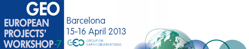
2013-Apr-17
EarthServer at the 7th GEO European Project Workshop in Barcelona
The GEO European Projects Workshop (GEPW) is a yearly event organized by te European Commission to develop the collaboration between the GEO initiative and the European Commission projects on Earth Observation funded through the Framework Programme of Community Research.
The 7th GEPW (GEPW-7) has taken place in Barcelona, on 15 and 16 April 2013, hosted by CREAF (Centre for Ecological Research and Forestry Applications) and the Universitat Autònoma of Barcelona, through the European project GeoViQua.
Peter Baumann has given a presentation on "Scalable, flexible, and Standards-Based Data Services: the EarthServer" in the session on "Research infrastructures and their contribution to GEOSS".
More information: http://gepw7.creaf.cat
2013-Apr-11
EarthServer at the EGU General Assembly in Vienna
The European Geosciences Union is dedicated to the pursuit of excellence in the geosciences and the planetary and space sciences for the benefit of humanity.
The annual EGU General Assembly is the largest and most prominent European geosciences event. It attracts over 11,000 scientists from all over the world, of which more than a quarter are students. The meeting's sessions, typically over 500, cover a wide range of topics, including volcanology, planetary exploration, the Earth's internal structure and atmosphere, climate, as well as energy and resources. General Assemblies have around 4,500 oral presentations and over 9,000 posters.
The EGU General Assembly 2013 has been held in Vienna on 07 - 12 April 2013. EarthServer participated with several oral presentations, posters and live demos illustrating the full range of on-going activities in the project:
- Simone Mantovani, Stefano Natali, Damiano Barboni, and Maria Grazia Veratelli, "Climate Data Service in the FP7 EarthServer Project" (live demo)
- Roberto Barbera, Riccardo Bruno, Antonio Calanducci, Antonio Messina, Marco Pappalardo, and Gianluca Passaro, "The EarthServer project: Exploiting Identity Federations, Science Gateways and Social and Mobile Clients for Big Earth Data Analysis", (Interactive presentation - PICO)
- John Laxton, Marcus Sen, and James Passmore "EarthServer - an FP7 project to enable the web delivery and analysis of 3D/4D models" (Oral presentation)
Peter Walker, Oliver Clements, and Mike Grant "EarthServer: Visualisation and use of uncertainty as a data exploration tool" (Poster)
- Thanassis Perperis, Panagiota Koltsida, and George Kakaletris, "EarthServer: Information Retrieval and Query Language" (Poster)
- Sebastian Wagner, Pasquale Herzig, Ulrich Bockholt, Yvonne Jung, and Johannes Behr "EarthServer - 3D Visualization on the Web" (Oral presentation)
- Oliver Clements, Peter Walker, and Mike Grant, "EarthServer: Use of Rasdaman as a data store for use in visualisation of complex EO data" (Poster)
A Keynote Lecture was given by Peter Baumann on "Data, Metadata - Who Cares?" a question arising from EarthServer research activities.
A Splinter Meeting was held on the topic "Big Data Analytics for Earth Science: the EarthServer approach". More than 30 researchers from all around the world attended it providing fruitful contribution to the open discussion
More information: http://www.egu2013.eu/
2013-Mar-31
EarthServer will contribute to the GEOSS Architecture Implementation Pilot phase 6
The GEOSS Architecture Implementation Pilot (AIP) develops and pilots new process and infrastructure components for the GCI and the broader GEOSS architecture. The main aims of AIP are to reach consensus on Interoperability Arrangements and to register operational components and services that carry forward into persistent operations of GEOSS.
EarthServer will participate in a proposal aiming to the enhancement of the GEOSS Common Infrastructure in the topic "GCI Research". The proposal has been called "GEOWOW & EarthServer" since it will experiment the enhancements to the GEOSS brokering infrastructure proposed in the GEOWOW project, also testing the interoperability with the EarthServer technology for handling large datasets. It will investigate the common point of interest of the two projects, that is the access services for coverage datasets, as proposed in the MoU between the two projects.
More information: http://www.ogcnetwork.net/node/1887
2013-Feb-27
Rasdaman Community Wiki
The Rasdaman Community Wiki can be accessed at the URL: http://rasdaman.eecs.jacobs-university.de/trac/rasdaman/wiki.
Users can register for providing contributions with the register link (http://rasdaman.eecs.jacobs-university.de/trac/rasdaman/register).
The rasdaman mailing lists are now hosted on Google Groups (http://rasdaman.eecs.jacobs-university.de/trac/rasdaman/wiki/MailingLists).
2013-Jan-15
EarthServer success at the OWS-9
The public demonstration of the results of the OGC Web Services Testbed Phase 9 (OWS-9) was held from 2:00-5:00 pm on Tuesday, 15 January at the OGC Technical Committee Meeting in Redlands (CA).
Peter Baumann and Stephan Meissl - representing Rasdaman GmBH, EOX, CNR-IIA and MEEO - successfully presented their contribution in the OWS Innovation and CITE threads. The resulting extensions of the OGC WCS 2.0 and reference implementations of WCS EO 1.0, were based on the research activities of EarthServer.
This success demonstrates the attention that the EarthServer project pays to standardization actvities.
The video and presentations are available online at the URLs:
https://plus.google.com/photos/113169221634253098049/albums/583222716/
http://212.201.49.173/~earthlook/videos/ows9-WCS_rasdaman.mp4
More information: http://www.opengeospatial.org/projects/initiatives/ows-9
2012-Nov-27
EarthServer participated in the GEO Plenary and side-events in Foz do Iguaçu
The Group on Earth Observations (GEO) was formally established at the Third Earth Observation Summit in February 2005 to carry out the Global Earth Observation System of Systems (GEOSS) 10-Year Implementation Plan. The GEO Plenary is the main body of designated representatives of the Members and Participating Organizations of the GEO and it is its primary decision-making body. The GEO Plenary meets at least once annually. In 2012 the GEO Plenary was held in Foz do Iguaçu, Brasil, from 22nd to 23rd of November. Several side-events were organized during the week from 19th to 23rd , including the EC-side event were several European projects contributing to GEO/GEOSS activities.
EarthServer participated in the event with an exhibition booth of Jacobs University of Bremen presenting EarthServer and Rasdaman technologies. A presentation on "Adding Big Earth Data Analytics to GEOSS" was given by Peter Baumann in the EC-side event (http://geoixplenary-ecside-event.teamwork.fr/en/programme).
More information: http://www.earthobservations.org/geo9.shtml
2012-Oct-31
EarthServer was discussed at the Geo-Seas international workshop in Cork, Ireland
Geo-Seas (http://www.geoseas.eu) is an FP7 project implementing an e-infrastructure of 26 marine geological and geophysical data centres, located in 17 European maritime countries. Users are enabled to identify, locate and access pan-European, harmonised and federated marine geological and geophysical datasets and derived data products held by the data centres through a single common data portal. The project is due to end in March 2013 and held an international workshop in Cork, Ireland, on 9-10/10/12 to demonstrate the project results and discuss future plans. John Laxton (BGS) attended and described how EarthServer could assist in the delivery and analysis of some of the large geological and geophysical data sets used by the marine geoscience community.
2012-Sep-03:
EarthServer presented at the GEOSS Stakeholders Workshop in Bonn
The 2nd GEOSS Science and Technology Stakeholder Workshop GEOSS: Supporting Science for the Millennium Development Goals and Beyond was held in Bonn, Germany, on August 28-31, 2012. The objective of the workshop was to review the science questions and research topics that need to be addressed in order to support progress towards the Millennium Development Goals (MDGs) and towards meeting the grand challenges, prior and after the current target date for the MDGs, and to identify Earth observations needed to facilitate the research.
Peter Baumann gave a presentation on "The EarthServer initiative: towards Agile Big Data Service" in the sessio"GEOSS' support for MDGs and Future Earth Research".
More information: http://www.geo-tasks.org/workshops/2012_Bonn/
2012-Aug:
The OGC adopts a Unified Coverages Encoding Standard
August 2012. The Open Geospatial Consortium (OGC) has adopted OGC GML Coverages (GMLCOV) 1.0.1 as an official OGC standard. OGC "coverages" are a unifying, standardized concept for the digital representation of phenomena that vary over space and possibly time. Examples of such geospatial coverages include Earth images, referenced and non-referenced rasters, curvilinear grids, and point clouds.
A corrigendum version has now been issued for the OGC GML 3.2.1 Application Schema - Coverages, nicknamed GMLCOV. Based on OGC Abstract Topic 6 (which is identical to ISO 19123), GMLCOV provides a unified method for representing OGC coverages in GML and any other suitable data format, such as GeoTIFF and NetCDF, and in a variety of dimensions, including 2-D x/y, 3-D x/y/t and x/y/z, and 4D x/y/z/t dimensions. As GMLCOV is independent of a particular service definition, it allows coverage data to be exchanged through different types of services that implement these OGC standards. As such, GMLCOV integrates Geography Markup Language (GML), the OGC Sensor Web Enablement (SWE) Common Standard, the OGC Web Coverage Service (WCS) Interface Standard, and others.
The new version, GMLCOV version 1.0.1, provides several enhancements, such as versatile encoding options that include binary formats with or without GML header. To better support this, modularization of the specification has been streamlined.
The OGC coverage model is widely used. For example, the European Commission has supported the development and unification of OGC coverages because these coverages are an important element in the standards framework for INSPIRE (the European legal framework for a common Spatial Data Infrastructure). Also, the widely used GMLJP2 standard, which augments JPEG2000 imagery data with GML-encoded geospatial metadata, relies on the GMLCOV standard.
GMLCOV is free and can be downloaded from at https://portal.opengeospatial.org/files/48553. The OGC is an international consortium of more than 460 companies, government agencies, research organizations, and universities participating in a consensus process to develop publicly available geospatial standards. OGC Standards support interoperable solutions that "geo-enable" the Web, wireless and location-based services, and mainstream IT. OGC Standards empower technology developers to make geospatial information and services accessible and useful with any application that needs to be geospatially enabled. Visit the OGC website at http://www.opengeospatial.org/contact.
source: http://www.rasdaman.com/News/2012/2012-09-xx_gmlcov-101.php
2012-jul-01:
EarthServer, ESPAS, iMarine meeting in Athens opportunities in array data management for Earth Observation.
On the 29th of June, 2012, a meeting among representatives of 3 active FP7 projects - EarthServer, ESPAS, iMarine - was organized in Athens, in an attempt to explore and extend the ground of collaboration among different scientific / technological taskforces and enable cross fertilization of results of their work in the area of scientific data management.
The main objective of the meeting was the building Îf consensus on the use and relevance of Array Data Management in the domain of (near) Earth Observation, given the nature and form of the data gathered and managed by the various disciplines involved in the aforementioned projects and even beyond them.
The EarthServer project (http://www.earthserver.eu/), is establishing an open access and ad-hoc analytics on extreme-size Earth Science data, based on and extending a leading-edge Array Database technology. The project is strengthening existing Open Geospatial Consortium standards and foresees demonstration of the feasibility of its endeavor through 6 lighthouse applications. On this landscape the project is providing base technology for managing raster data, powered by RASDAMAN, one of the best known solutions in the domain, and can benefit from external requests and feedback such as the ones that can be raised by projects such as ESPAS and iMarine.
On the technology field, the ESPAS project (http://www.espas-fp7.eu/) is building an infrastructure of services to support and manage near Earth Observation data, as well as the tools for their exploitation in the scientific domain. Apart from dealing with an important volume of data (more than 40 repositories), that has to be comprehended, modeled and managed, ESPAS project also explores and exploits a number of baseline technologies for building its advanced discovery and processing services. Both directions of actions feed a strong motivation for seeking collaboration with projects such as ESPAS and iMarine.
The iMarine project (http://www.i-marine.eu) is empowering users, in the marine community and beyond, by providing a highly efficient e-Infrastructure to accelerate data discovery, exchange and analysis as well as the tools and platforms that facilitate scientific discovery. The technology provided by EarthServer, as well as infrastructures such as the one provided by ESPAS, are valid candidates for interoperability with the iMarine's gCube-powered infrastructure, as they can enlarge the EcoSystem with new resources, technology or/and data, a potential outcome that falls directly within the main objectives of the project.
Partners represented in the meeting were: Jacobs University (DE), Athena Research Center (GR), and the National and Kapodistrian University of Athens (GR). The meeting was hosted by Department of Informatics and Telecommunications of the National and Kapodistriaan University of Athens.
2012-May-15:
EarthServer participates in OWS-9
On 22nd February 2012 the Open Geospatial Consortium (OGC) has issued a Request for Quotations/Call for Participation (RFQ/CFP) to solicit proposals in response to requirements for the OGC Web Services, Phase 9 (OWS-9) Testbed. OWS testbeds are part of OGC's Interoperability Program, a global, hands-on and collaborative prototyping program designed to rapidly develop, test and deliver proven candidate specifications into OGC's Specification Program, where they are formalized for public release.
The EarthServer Consortium members Rasdaman GmbH, EOX, MEEO and CNR have prepared a proposal to contribute to the OWS Innovation (OWSI) and Compliance and Interoperability Testing Initiative (CITE) threads, providing WCS 2.0 specifications and extensions, and the WCS EO 1.0 Server Reference Implementation. The proposal has been approved and co-funded by OGC. The activities will start in June 2012 and it will end in January 2013.
More information: http://www.opengeospatial.org/projects/initiatives/ows-9
Rasdaman inventor now OSGeo Charter Member
Bremen, August 2013. Peter Baumann, Professor of Computer Science, has been elected Charter Member of OSGeo.
The Open Source Geospatial Foundation, or OSGeo, is a not-for-profit organization whose mission is to support the collaborative development of open source geospatial software, and promote its widespread use. OSGeo also serves as an outreach and advocacy organization for the open source geospatial community, and provides a common forum and shared infrastructure for improving cross-project collaboration.
"It is an exciting opportunity to support the open source idea in all its variety", says Peter Baumann and explains, "Not only do the Charter Members elect the Board of Directors, but they also actively contribute in discussion." Baumann is well known in OSGeo circles with the Big Data Analytics engine, rasdaman, which is jointly developed by Jacobs University and rasdaman GmbH, a research spinoff. Research around rasdaman has pioneered the area of Array Databases, which is seen as a key Big Data technology by major database vendors. Further, Baumann is editor of international standards in the field and chair of several standards working groups.
More information:
http://www.osgeo.org http://en.wikipedia.org/wiki/Rasdaman http://en.wikipedia.org/wiki/Array_DBMS
2013-Ago-20
OGC Progressing with Function-Rich Big Data Standards
August 20, 2013. Yesterday voting on the new OGC standard for Coordinate System handling of spatio-temporal data sets has finished with all YES votes. This extends the OGC Web Coverage Service (WCS) suite, together with several further specifications submitted earlier which are disclosed for public commenting. Together, this makes WCS Swiss Army Knife for big and small coverage data, such as sensor data, raster images, timeseries, point clouds, and meshes.
Among the supporters of the new "OGC WCS Extension - CRS" with OGC document number 11-053 are US NOAA and USGS, German AdV, French BRGM and METEO-FRANCE, Australian CSIRO, the European Union Stellite Centre, Oracle, and EADS. "This new standard closes an important gap, as for the first time it allows to treat spatial and temporal coordinates alike" explains Peter Baumann from Jacobs University, the editor of the specification, and details "this will tremendously ease access to and analysis of satellite image timeseries and weather data, for example".
Prior to voting on the adoption of a standard, as with WCS CRS, OGC mandates a public Request for Comment period where the candidate standard is made available to the public and comments are sought. The document editors duly consider all comments, and the revised version goes into voting.
In case of WCS, several further specifications are in this pipeline: WCS Range Subsetting, which allows to extract channels from hyperspectral images or multi-variable climate data sets; WCS Processing, which establishes a bridget between the simple data access protocol of WCS and the advanced filtering and processing query language of the Web Coverage Processing Service (WCPS); WCS Scaling, which allows clients to get downscaled data sets with reduced resolution, such as for Web browser display and thumbnails; WCS Interpolation, which gives clients fine-grain control over any interpolation the server performs during its processing.
A RESTful protocol binding for WCS is in progress by the OGC WCS Standards Working Group and will likely be rolled out soon as well.
"The team has worked hard over the last few years, and now we are reaping the benefits - WCS is the most powerful, comprehensive Big Earth Data service suite available" says Peter Baumann. "Not the least because we have harmonized it across OGC, so that coverages can be exchanged freely between WFS, WCS, WCPS, WPS, and SOS."
http://external.opengeospatial.org/twiki_public/CoveragesDWG/WebHome
2013-Jun-30
Big Data from Space... directly to the Users
Frascati, 12 June 2013. How can we make the large amounts of Earth observation data accessible to a wider user community? To explore this idea, some 250 science, industry and policy-making representatives and national delegates from Europe, the US, Australia, China, and Africa met at ESA's ESRIN space centre in Frascati, Italy for ESA's first "Big Data from Space" event.
Data from Earth observing satellites and other remote sensing technologies are growing in volume and diversity at an exceptionally fast rate. This poses challenges and opportunities for their quick access, stewardship and applications.
Peter Baumann was invited to present Jacobs University's research on flexible, scalable search and processing on huge data archives, Overall, more than 50 presentations during the three-day conference stimulated discussion between the different communities involved in the business of providing and manipulating very large-scale data and complex analyses of satellite and in situ Earth observations.
Diversity of space data, the combined use of data from different space missions and the fusion of satellite data with non-space data lead to new types of user applications. This affects the way such data are collected, processed, delivered and preserved. There is an increasing need to serve a wider user community looking to retrieve simple, understandable and immediate information from remotely sensed data that have undergone complex processes and analyses.
Given the overwhelming success of the event, ESA is now considering whether this can become a recurring event.
2013-Jun-29
INSPIRE Conference in Florence
The aim of this year's INSPIRE Conference (INSPIRE 2013: The Green Renaissance) was to further exchange views and experiences on how INSPIRE is meeting past and emerging challenges and needs. To identify new opportunities and to finally, reflect collectively on how INSPIRE can further evolve to maximise its benefits for society.
Alan Beccati (Jacobs University of Bremen) gave a talk about "WCS as a Download Service for Big (and Small) Data" presenting some relevant outcomes of the EarthServer project.
More information: http://inspire.jrc.ec.europa.eu/events/conferences/inspire_2013/
2013-Jun-15
Cloud support available with open-source rasdaman
Bremen, May 24, 2013: The new release of open-source rasdaman 8.4.2 supports fully transparent distribution of query workloads across a network. Nodes can join and leave the network at any time, allowing the cloud or cluster to adjust traffic and grow and shrink dynamically.
"Rasdaman now seamlessly scales from laptop to cloud and clusters", says Dr. Peter Baumann, CEO and Professor at Jacobs University. "But we are already going beyond this, preparing dynamic query splitting for the next version".
Security is an important aspect of such federated processing. Accessibility administration ranges from centralized control of the whole cloud to single-node access rules. This way, control remains fully with the administrator of each node.
The open-source rasdaman project is led by Jacobs University, Bremen in collaboration with the research spin-off, rasdaman GmbH, which also offers proprietary rasdaman enterprise. Data archives and producers worldwide like Deutscher Wetterdienst (German Metoffice), NASA, and Vito / Belgium are using rasdaman.
http://www.rasdaman.org/
2013-Jun-15
OGC RESTful Big Data API Published
Geo services typically have to deal with Big Data when hosting sensor, image, simulation, and statistics data. Now the elegant RESTful API style is becoming reality with the Web Coverage Service (WCS) REST Extension which has been made public by the WCS standards working group.
WCS provides open access to multi-dimensional spatio-temporal data, summarized as coverage data. Functionality ranges from simple subsetting in space and time over scaling, band extraction, etc. to a powerful query language, the Web Coverage Processing Service (WCPS). The REST (Representational State Transfer) paradigm is a particularly simple, yet powerful style for using the language of the Web, HTTP. The WCS Standards Working Group (WCS.SWG) is working on a RESTful protocol binding for WCS which will allow clients to send requests through this paradigm - in the extreme case even by simply typing a short stanza into a browser address line.
This candidate interface standard now has been made openly available for public inspection and discussion on the OGC web site [1]. "This is quite novel, and we are hoping for two effects: community checks for possible shortcomings, and fast proliferation and uptake" says Peter Baumann, editor of the specification. "In parallel to the adoption process, we will establish an open-source implementation based on the WCS Core Reference Implementation, rasdaman".
More information: http://external.opengeospatial.org/twiki_public/CoveragesDWG/WcsRest
2013-Jun-12
EarthServer at the Big Data from Space Conference
The European Space Agency in Frascati organized a "Big data from Space" event to address the barriers that hamper an effective use of large volumes of Earth observation data. The event focused on issues associated with the organisation and delivery of large volumes of contemporary and historical Earth observations, either space-based or from ground (including ubiquitous information-sensing mobile devices, aerial sensory t echnologies, wireless sensor networks).
The event was held at the ESA's Centre for Earth Observation (ESRIN) located in Frascati on 5-7 June 2013.
The event was sponsored by EarthServer project, that also participated in the Organizing and Scientific Committees.
EarthServer contributed with several oral presentations and posters illustrating a wide range of ongoing activities in the project:
- Peter Walker et al., Combining uncertainty information and server based data exploration and visualisation to analyse large datasets - Oral presentation
- Peter Baumann, Let's Talk About Big Data: a Language Based Approach - Oral presentation
- Alan Beccati et al. Array-database powered services for big spaceborne spatio-temporal coverages - Poster
- Thanassis Perperis et al., Combined Data and Metadata Retrieval in EarthServer - Poster
- Gerhard Triebnig et al., Online Big Data Access: The EOxServer Open Source Software Initiative and Current Deployments - Poster
- Simone Mantovani et al., WCS/WCPS access to Level-2 / Level-3 Space Earth and Atmosphere Products - Poster
More information: http://www.congrexprojects.com/13C10/
2013-Apr-17
EarthServer at the 7th GEO European Project Workshop in Barcelona
The GEO European Projects Workshop (GEPW) is a yearly event organized by te European Commission to develop the collaboration between the GEO initiative and the European Commission projects on Earth Observation funded through the Framework Programme of Community Research.
The 7th GEPW (GEPW-7) has taken place in Barcelona, on 15 and 16 April 2013, hosted by CREAF (Centre for Ecological Research and Forestry Applications) and the Universitat Autònoma of Barcelona, through the European project GeoViQua.
Peter Baumann has given a presentation on "Scalable, flexible, and Standards-Based Data Services: the EarthServer" in the session on "Research infrastructures and their contribution to GEOSS".
More information: http://gepw7.creaf.cat
2013-Apr-11
EarthServer at the EGU General Assembly in Vienna
The European Geosciences Union is dedicated to the pursuit of excellence in the geosciences and the planetary and space sciences for the benefit of humanity.
The annual EGU General Assembly is the largest and most prominent European geosciences event. It attracts over 11,000 scientists from all over the world, of which more than a quarter are students. The meeting's sessions, typically over 500, cover a wide range of topics, including volcanology, planetary exploration, the Earth's internal structure and atmosphere, climate, as well as energy and resources. General Assemblies have around 4,500 oral presentations and over 9,000 posters.
The EGU General Assembly 2013 has been held in Vienna on 07 - 12 April 2013. EarthServer participated with several oral presentations, posters and live demos illustrating the full range of on-going activities in the project:
- Simone Mantovani, Stefano Natali, Damiano Barboni, and Maria Grazia Veratelli, "Climate Data Service in the FP7 EarthServer Project" (live demo)
- Roberto Barbera, Riccardo Bruno, Antonio Calanducci, Antonio Messina, Marco Pappalardo, and Gianluca Passaro, "The EarthServer project: Exploiting Identity Federations, Science Gateways and Social and Mobile Clients for Big Earth Data Analysis", (Interactive presentation - PICO)
- John Laxton, Marcus Sen, and James Passmore "EarthServer - an FP7 project to enable the web delivery and analysis of 3D/4D models" (Oral presentation)
Peter Walker, Oliver Clements, and Mike Grant "EarthServer: Visualisation and use of uncertainty as a data exploration tool" (Poster)
- Thanassis Perperis, Panagiota Koltsida, and George Kakaletris, "EarthServer: Information Retrieval and Query Language" (Poster)
- Sebastian Wagner, Pasquale Herzig, Ulrich Bockholt, Yvonne Jung, and Johannes Behr "EarthServer - 3D Visualization on the Web" (Oral presentation)
- Oliver Clements, Peter Walker, and Mike Grant, "EarthServer: Use of Rasdaman as a data store for use in visualisation of complex EO data" (Poster)
A Keynote Lecture was given by Peter Baumann on "Data, Metadata - Who Cares?" a question arising from EarthServer research activities.
A Splinter Meeting was held on the topic "Big Data Analytics for Earth Science: the EarthServer approach". More than 30 researchers from all around the world attended it providing fruitful contribution to the open discussion
More information: http://www.egu2013.eu/
2013-Mar-31
EarthServer will contribute to the GEOSS Architecture Implementation Pilot phase 6
The GEOSS Architecture Implementation Pilot (AIP) develops and pilots new process and infrastructure components for the GCI and the broader GEOSS architecture. The main aims of AIP are to reach consensus on Interoperability Arrangements and to register operational components and services that carry forward into persistent operations of GEOSS.
EarthServer will participate in a proposal aiming to the enhancement of the GEOSS Common Infrastructure in the topic "GCI Research". The proposal has been called "GEOWOW & EarthServer" since it will experiment the enhancements to the GEOSS brokering infrastructure proposed in the GEOWOW project, also testing the interoperability with the EarthServer technology for handling large datasets. It will investigate the common point of interest of the two projects, that is the access services for coverage datasets, as proposed in the MoU between the two projects.
More information: http://www.ogcnetwork.net/node/1887
2013-Feb-27
Rasdaman Community Wiki
The Rasdaman Community Wiki can be accessed at the URL: http://rasdaman.eecs.jacobs-university.de/trac/rasdaman/wiki.
Users can register for providing contributions with the register link (http://rasdaman.eecs.jacobs-university.de/trac/rasdaman/register).
The rasdaman mailing lists are now hosted on Google Groups (http://rasdaman.eecs.jacobs-university.de/trac/rasdaman/wiki/MailingLists).
2013-Jan-15
EarthServer success at the OWS-9
The public demonstration of the results of the OGC Web Services Testbed Phase 9 (OWS-9) was held from 2:00-5:00 pm on Tuesday, 15 January at the OGC Technical Committee Meeting in Redlands (CA).
Peter Baumann and Stephan Meissl - representing Rasdaman GmBH, EOX, CNR-IIA and MEEO - successfully presented their contribution in the OWS Innovation and CITE threads. The resulting extensions of the OGC WCS 2.0 and reference implementations of WCS EO 1.0, were based on the research activities of EarthServer.
This success demonstrates the attention that the EarthServer project pays to standardization actvities.
The video and presentations are available online at the URLs:
https://plus.google.com/photos/113169221634253098049/albums/583222716/
http://212.201.49.173/~earthlook/videos/ows9-WCS_rasdaman.mp4
More information: http://www.opengeospatial.org/projects/initiatives/ows-9
2012-Nov-27
EarthServer participated in the GEO Plenary and side-events in Foz do Iguaçu
The Group on Earth Observations (GEO) was formally established at the Third Earth Observation Summit in February 2005 to carry out the Global Earth Observation System of Systems (GEOSS) 10-Year Implementation Plan. The GEO Plenary is the main body of designated representatives of the Members and Participating Organizations of the GEO and it is its primary decision-making body. The GEO Plenary meets at least once annually. In 2012 the GEO Plenary was held in Foz do Iguaçu, Brasil, from 22nd to 23rd of November. Several side-events were organized during the week from 19th to 23rd , including the EC-side event were several European projects contributing to GEO/GEOSS activities.
EarthServer participated in the event with an exhibition booth of Jacobs University of Bremen presenting EarthServer and Rasdaman technologies. A presentation on "Adding Big Earth Data Analytics to GEOSS" was given by Peter Baumann in the EC-side event (http://geoixplenary-ecside-event.teamwork.fr/en/programme).
More information: http://www.earthobservations.org/geo9.shtml
2012-Oct-31
EarthServer was discussed at the Geo-Seas international workshop in Cork, Ireland
Geo-Seas (http://www.geoseas.eu) is an FP7 project implementing an e-infrastructure of 26 marine geological and geophysical data centres, located in 17 European maritime countries. Users are enabled to identify, locate and access pan-European, harmonised and federated marine geological and geophysical datasets and derived data products held by the data centres through a single common data portal. The project is due to end in March 2013 and held an international workshop in Cork, Ireland, on 9-10/10/12 to demonstrate the project results and discuss future plans. John Laxton (BGS) attended and described how EarthServer could assist in the delivery and analysis of some of the large geological and geophysical data sets used by the marine geoscience community.
2012-Sep-03:
EarthServer presented at the GEOSS Stakeholders Workshop in Bonn
The 2nd GEOSS Science and Technology Stakeholder Workshop GEOSS: Supporting Science for the Millennium Development Goals and Beyond was held in Bonn, Germany, on August 28-31, 2012. The objective of the workshop was to review the science questions and research topics that need to be addressed in order to support progress towards the Millennium Development Goals (MDGs) and towards meeting the grand challenges, prior and after the current target date for the MDGs, and to identify Earth observations needed to facilitate the research.
Peter Baumann gave a presentation on "The EarthServer initiative: towards Agile Big Data Service" in the sessio"GEOSS' support for MDGs and Future Earth Research".
More information: http://www.geo-tasks.org/workshops/2012_Bonn/
2012-Aug:
The OGC adopts a Unified Coverages Encoding Standard
August 2012. The Open Geospatial Consortium (OGC) has adopted OGC GML Coverages (GMLCOV) 1.0.1 as an official OGC standard. OGC "coverages" are a unifying, standardized concept for the digital representation of phenomena that vary over space and possibly time. Examples of such geospatial coverages include Earth images, referenced and non-referenced rasters, curvilinear grids, and point clouds.
A corrigendum version has now been issued for the OGC GML 3.2.1 Application Schema - Coverages, nicknamed GMLCOV. Based on OGC Abstract Topic 6 (which is identical to ISO 19123), GMLCOV provides a unified method for representing OGC coverages in GML and any other suitable data format, such as GeoTIFF and NetCDF, and in a variety of dimensions, including 2-D x/y, 3-D x/y/t and x/y/z, and 4D x/y/z/t dimensions. As GMLCOV is independent of a particular service definition, it allows coverage data to be exchanged through different types of services that implement these OGC standards. As such, GMLCOV integrates Geography Markup Language (GML), the OGC Sensor Web Enablement (SWE) Common Standard, the OGC Web Coverage Service (WCS) Interface Standard, and others.
The new version, GMLCOV version 1.0.1, provides several enhancements, such as versatile encoding options that include binary formats with or without GML header. To better support this, modularization of the specification has been streamlined.
The OGC coverage model is widely used. For example, the European Commission has supported the development and unification of OGC coverages because these coverages are an important element in the standards framework for INSPIRE (the European legal framework for a common Spatial Data Infrastructure). Also, the widely used GMLJP2 standard, which augments JPEG2000 imagery data with GML-encoded geospatial metadata, relies on the GMLCOV standard.
GMLCOV is free and can be downloaded from at https://portal.opengeospatial.org/files/48553. The OGC is an international consortium of more than 460 companies, government agencies, research organizations, and universities participating in a consensus process to develop publicly available geospatial standards. OGC Standards support interoperable solutions that "geo-enable" the Web, wireless and location-based services, and mainstream IT. OGC Standards empower technology developers to make geospatial information and services accessible and useful with any application that needs to be geospatially enabled. Visit the OGC website at http://www.opengeospatial.org/contact.
source: http://www.rasdaman.com/News/2012/2012-09-xx_gmlcov-101.php
2012-jul-01:
EarthServer, ESPAS, iMarine meeting in Athens opportunities in array data management for Earth Observation.
On the 29th of June, 2012, a meeting among representatives of 3 active FP7 projects - EarthServer, ESPAS, iMarine - was organized in Athens, in an attempt to explore and extend the ground of collaboration among different scientific / technological taskforces and enable cross fertilization of results of their work in the area of scientific data management.
The main objective of the meeting was the building Îf consensus on the use and relevance of Array Data Management in the domain of (near) Earth Observation, given the nature and form of the data gathered and managed by the various disciplines involved in the aforementioned projects and even beyond them.
The EarthServer project (http://www.earthserver.eu/), is establishing an open access and ad-hoc analytics on extreme-size Earth Science data, based on and extending a leading-edge Array Database technology. The project is strengthening existing Open Geospatial Consortium standards and foresees demonstration of the feasibility of its endeavor through 6 lighthouse applications. On this landscape the project is providing base technology for managing raster data, powered by RASDAMAN, one of the best known solutions in the domain, and can benefit from external requests and feedback such as the ones that can be raised by projects such as ESPAS and iMarine.
On the technology field, the ESPAS project (http://www.espas-fp7.eu/) is building an infrastructure of services to support and manage near Earth Observation data, as well as the tools for their exploitation in the scientific domain. Apart from dealing with an important volume of data (more than 40 repositories), that has to be comprehended, modeled and managed, ESPAS project also explores and exploits a number of baseline technologies for building its advanced discovery and processing services. Both directions of actions feed a strong motivation for seeking collaboration with projects such as ESPAS and iMarine.
The iMarine project (http://www.i-marine.eu) is empowering users, in the marine community and beyond, by providing a highly efficient e-Infrastructure to accelerate data discovery, exchange and analysis as well as the tools and platforms that facilitate scientific discovery. The technology provided by EarthServer, as well as infrastructures such as the one provided by ESPAS, are valid candidates for interoperability with the iMarine's gCube-powered infrastructure, as they can enlarge the EcoSystem with new resources, technology or/and data, a potential outcome that falls directly within the main objectives of the project.
Partners represented in the meeting were: Jacobs University (DE), Athena Research Center (GR), and the National and Kapodistrian University of Athens (GR). The meeting was hosted by Department of Informatics and Telecommunications of the National and Kapodistriaan University of Athens.
2012-May-15:
EarthServer participates in OWS-9
On 22nd February 2012 the Open Geospatial Consortium (OGC) has issued a Request for Quotations/Call for Participation (RFQ/CFP) to solicit proposals in response to requirements for the OGC Web Services, Phase 9 (OWS-9) Testbed. OWS testbeds are part of OGC's Interoperability Program, a global, hands-on and collaborative prototyping program designed to rapidly develop, test and deliver proven candidate specifications into OGC's Specification Program, where they are formalized for public release.
The EarthServer Consortium members Rasdaman GmbH, EOX, MEEO and CNR have prepared a proposal to contribute to the OWS Innovation (OWSI) and Compliance and Interoperability Testing Initiative (CITE) threads, providing WCS 2.0 specifications and extensions, and the WCS EO 1.0 Server Reference Implementation. The proposal has been approved and co-funded by OGC. The activities will start in June 2012 and it will end in January 2013.
More information: http://www.opengeospatial.org/projects/initiatives/ows-9
OGC Progressing with Function-Rich Big Data Standards
August 20, 2013. Yesterday voting on the new OGC standard for Coordinate System handling of spatio-temporal data sets has finished with all YES votes. This extends the OGC Web Coverage Service (WCS) suite, together with several further specifications submitted earlier which are disclosed for public commenting. Together, this makes WCS Swiss Army Knife for big and small coverage data, such as sensor data, raster images, timeseries, point clouds, and meshes. Among the supporters of the new "OGC WCS Extension - CRS" with OGC document number 11-053 are US NOAA and USGS, German AdV, French BRGM and METEO-FRANCE, Australian CSIRO, the European Union Stellite Centre, Oracle, and EADS. "This new standard closes an important gap, as for the first time it allows to treat spatial and temporal coordinates alike" explains Peter Baumann from Jacobs University, the editor of the specification, and details "this will tremendously ease access to and analysis of satellite image timeseries and weather data, for example". Prior to voting on the adoption of a standard, as with WCS CRS, OGC mandates a public Request for Comment period where the candidate standard is made available to the public and comments are sought. The document editors duly consider all comments, and the revised version goes into voting. In case of WCS, several further specifications are in this pipeline: WCS Range Subsetting, which allows to extract channels from hyperspectral images or multi-variable climate data sets; WCS Processing, which establishes a bridget between the simple data access protocol of WCS and the advanced filtering and processing query language of the Web Coverage Processing Service (WCPS); WCS Scaling, which allows clients to get downscaled data sets with reduced resolution, such as for Web browser display and thumbnails; WCS Interpolation, which gives clients fine-grain control over any interpolation the server performs during its processing. A RESTful protocol binding for WCS is in progress by the OGC WCS Standards Working Group and will likely be rolled out soon as well. "The team has worked hard over the last few years, and now we are reaping the benefits - WCS is the most powerful, comprehensive Big Earth Data service suite available" says Peter Baumann. "Not the least because we have harmonized it across OGC, so that coverages can be exchanged freely between WFS, WCS, WCPS, WPS, and SOS." http://external.opengeospatial.org/twiki_public/CoveragesDWG/WebHome
2013-Jun-30
Big Data from Space... directly to the Users
Frascati, 12 June 2013. How can we make the large amounts of Earth observation data accessible to a wider user community? To explore this idea, some 250 science, industry and policy-making representatives and national delegates from Europe, the US, Australia, China, and Africa met at ESA's ESRIN space centre in Frascati, Italy for ESA's first "Big Data from Space" event.
Data from Earth observing satellites and other remote sensing technologies are growing in volume and diversity at an exceptionally fast rate. This poses challenges and opportunities for their quick access, stewardship and applications.
Peter Baumann was invited to present Jacobs University's research on flexible, scalable search and processing on huge data archives, Overall, more than 50 presentations during the three-day conference stimulated discussion between the different communities involved in the business of providing and manipulating very large-scale data and complex analyses of satellite and in situ Earth observations.
Diversity of space data, the combined use of data from different space missions and the fusion of satellite data with non-space data lead to new types of user applications. This affects the way such data are collected, processed, delivered and preserved. There is an increasing need to serve a wider user community looking to retrieve simple, understandable and immediate information from remotely sensed data that have undergone complex processes and analyses.
Given the overwhelming success of the event, ESA is now considering whether this can become a recurring event.
2013-Jun-29
INSPIRE Conference in Florence
The aim of this year's INSPIRE Conference (INSPIRE 2013: The Green Renaissance) was to further exchange views and experiences on how INSPIRE is meeting past and emerging challenges and needs. To identify new opportunities and to finally, reflect collectively on how INSPIRE can further evolve to maximise its benefits for society.
Alan Beccati (Jacobs University of Bremen) gave a talk about "WCS as a Download Service for Big (and Small) Data" presenting some relevant outcomes of the EarthServer project.
More information: http://inspire.jrc.ec.europa.eu/events/conferences/inspire_2013/
2013-Jun-15
Cloud support available with open-source rasdaman
Bremen, May 24, 2013: The new release of open-source rasdaman 8.4.2 supports fully transparent distribution of query workloads across a network. Nodes can join and leave the network at any time, allowing the cloud or cluster to adjust traffic and grow and shrink dynamically.
"Rasdaman now seamlessly scales from laptop to cloud and clusters", says Dr. Peter Baumann, CEO and Professor at Jacobs University. "But we are already going beyond this, preparing dynamic query splitting for the next version".
Security is an important aspect of such federated processing. Accessibility administration ranges from centralized control of the whole cloud to single-node access rules. This way, control remains fully with the administrator of each node.
The open-source rasdaman project is led by Jacobs University, Bremen in collaboration with the research spin-off, rasdaman GmbH, which also offers proprietary rasdaman enterprise. Data archives and producers worldwide like Deutscher Wetterdienst (German Metoffice), NASA, and Vito / Belgium are using rasdaman.
http://www.rasdaman.org/
2013-Jun-15
OGC RESTful Big Data API Published
Geo services typically have to deal with Big Data when hosting sensor, image, simulation, and statistics data. Now the elegant RESTful API style is becoming reality with the Web Coverage Service (WCS) REST Extension which has been made public by the WCS standards working group.
WCS provides open access to multi-dimensional spatio-temporal data, summarized as coverage data. Functionality ranges from simple subsetting in space and time over scaling, band extraction, etc. to a powerful query language, the Web Coverage Processing Service (WCPS). The REST (Representational State Transfer) paradigm is a particularly simple, yet powerful style for using the language of the Web, HTTP. The WCS Standards Working Group (WCS.SWG) is working on a RESTful protocol binding for WCS which will allow clients to send requests through this paradigm - in the extreme case even by simply typing a short stanza into a browser address line.
This candidate interface standard now has been made openly available for public inspection and discussion on the OGC web site [1]. "This is quite novel, and we are hoping for two effects: community checks for possible shortcomings, and fast proliferation and uptake" says Peter Baumann, editor of the specification. "In parallel to the adoption process, we will establish an open-source implementation based on the WCS Core Reference Implementation, rasdaman".
More information: http://external.opengeospatial.org/twiki_public/CoveragesDWG/WcsRest
2013-Jun-12
EarthServer at the Big Data from Space Conference
The European Space Agency in Frascati organized a "Big data from Space" event to address the barriers that hamper an effective use of large volumes of Earth observation data. The event focused on issues associated with the organisation and delivery of large volumes of contemporary and historical Earth observations, either space-based or from ground (including ubiquitous information-sensing mobile devices, aerial sensory t echnologies, wireless sensor networks).
The event was held at the ESA's Centre for Earth Observation (ESRIN) located in Frascati on 5-7 June 2013.
The event was sponsored by EarthServer project, that also participated in the Organizing and Scientific Committees.
EarthServer contributed with several oral presentations and posters illustrating a wide range of ongoing activities in the project:
- Peter Walker et al., Combining uncertainty information and server based data exploration and visualisation to analyse large datasets - Oral presentation
- Peter Baumann, Let's Talk About Big Data: a Language Based Approach - Oral presentation
- Alan Beccati et al. Array-database powered services for big spaceborne spatio-temporal coverages - Poster
- Thanassis Perperis et al., Combined Data and Metadata Retrieval in EarthServer - Poster
- Gerhard Triebnig et al., Online Big Data Access: The EOxServer Open Source Software Initiative and Current Deployments - Poster
- Simone Mantovani et al., WCS/WCPS access to Level-2 / Level-3 Space Earth and Atmosphere Products - Poster
More information: http://www.congrexprojects.com/13C10/
2013-Apr-17
EarthServer at the 7th GEO European Project Workshop in Barcelona
The GEO European Projects Workshop (GEPW) is a yearly event organized by te European Commission to develop the collaboration between the GEO initiative and the European Commission projects on Earth Observation funded through the Framework Programme of Community Research.
The 7th GEPW (GEPW-7) has taken place in Barcelona, on 15 and 16 April 2013, hosted by CREAF (Centre for Ecological Research and Forestry Applications) and the Universitat Autònoma of Barcelona, through the European project GeoViQua.
Peter Baumann has given a presentation on "Scalable, flexible, and Standards-Based Data Services: the EarthServer" in the session on "Research infrastructures and their contribution to GEOSS".
More information: http://gepw7.creaf.cat
2013-Apr-11
EarthServer at the EGU General Assembly in Vienna
The European Geosciences Union is dedicated to the pursuit of excellence in the geosciences and the planetary and space sciences for the benefit of humanity.
The annual EGU General Assembly is the largest and most prominent European geosciences event. It attracts over 11,000 scientists from all over the world, of which more than a quarter are students. The meeting's sessions, typically over 500, cover a wide range of topics, including volcanology, planetary exploration, the Earth's internal structure and atmosphere, climate, as well as energy and resources. General Assemblies have around 4,500 oral presentations and over 9,000 posters.
The EGU General Assembly 2013 has been held in Vienna on 07 - 12 April 2013. EarthServer participated with several oral presentations, posters and live demos illustrating the full range of on-going activities in the project:
- Simone Mantovani, Stefano Natali, Damiano Barboni, and Maria Grazia Veratelli, "Climate Data Service in the FP7 EarthServer Project" (live demo)
- Roberto Barbera, Riccardo Bruno, Antonio Calanducci, Antonio Messina, Marco Pappalardo, and Gianluca Passaro, "The EarthServer project: Exploiting Identity Federations, Science Gateways and Social and Mobile Clients for Big Earth Data Analysis", (Interactive presentation - PICO)
- John Laxton, Marcus Sen, and James Passmore "EarthServer - an FP7 project to enable the web delivery and analysis of 3D/4D models" (Oral presentation)
Peter Walker, Oliver Clements, and Mike Grant "EarthServer: Visualisation and use of uncertainty as a data exploration tool" (Poster)
- Thanassis Perperis, Panagiota Koltsida, and George Kakaletris, "EarthServer: Information Retrieval and Query Language" (Poster)
- Sebastian Wagner, Pasquale Herzig, Ulrich Bockholt, Yvonne Jung, and Johannes Behr "EarthServer - 3D Visualization on the Web" (Oral presentation)
- Oliver Clements, Peter Walker, and Mike Grant, "EarthServer: Use of Rasdaman as a data store for use in visualisation of complex EO data" (Poster)
A Keynote Lecture was given by Peter Baumann on "Data, Metadata - Who Cares?" a question arising from EarthServer research activities.
A Splinter Meeting was held on the topic "Big Data Analytics for Earth Science: the EarthServer approach". More than 30 researchers from all around the world attended it providing fruitful contribution to the open discussion
More information: http://www.egu2013.eu/
2013-Mar-31
EarthServer will contribute to the GEOSS Architecture Implementation Pilot phase 6
The GEOSS Architecture Implementation Pilot (AIP) develops and pilots new process and infrastructure components for the GCI and the broader GEOSS architecture. The main aims of AIP are to reach consensus on Interoperability Arrangements and to register operational components and services that carry forward into persistent operations of GEOSS.
EarthServer will participate in a proposal aiming to the enhancement of the GEOSS Common Infrastructure in the topic "GCI Research". The proposal has been called "GEOWOW & EarthServer" since it will experiment the enhancements to the GEOSS brokering infrastructure proposed in the GEOWOW project, also testing the interoperability with the EarthServer technology for handling large datasets. It will investigate the common point of interest of the two projects, that is the access services for coverage datasets, as proposed in the MoU between the two projects.
More information: http://www.ogcnetwork.net/node/1887
2013-Feb-27
Rasdaman Community Wiki
The Rasdaman Community Wiki can be accessed at the URL: http://rasdaman.eecs.jacobs-university.de/trac/rasdaman/wiki.
Users can register for providing contributions with the register link (http://rasdaman.eecs.jacobs-university.de/trac/rasdaman/register).
The rasdaman mailing lists are now hosted on Google Groups (http://rasdaman.eecs.jacobs-university.de/trac/rasdaman/wiki/MailingLists).
2013-Jan-15
EarthServer success at the OWS-9
The public demonstration of the results of the OGC Web Services Testbed Phase 9 (OWS-9) was held from 2:00-5:00 pm on Tuesday, 15 January at the OGC Technical Committee Meeting in Redlands (CA).
Peter Baumann and Stephan Meissl - representing Rasdaman GmBH, EOX, CNR-IIA and MEEO - successfully presented their contribution in the OWS Innovation and CITE threads. The resulting extensions of the OGC WCS 2.0 and reference implementations of WCS EO 1.0, were based on the research activities of EarthServer.
This success demonstrates the attention that the EarthServer project pays to standardization actvities.
The video and presentations are available online at the URLs:
https://plus.google.com/photos/113169221634253098049/albums/583222716/
http://212.201.49.173/~earthlook/videos/ows9-WCS_rasdaman.mp4
More information: http://www.opengeospatial.org/projects/initiatives/ows-9
2012-Nov-27
EarthServer participated in the GEO Plenary and side-events in Foz do Iguaçu
The Group on Earth Observations (GEO) was formally established at the Third Earth Observation Summit in February 2005 to carry out the Global Earth Observation System of Systems (GEOSS) 10-Year Implementation Plan. The GEO Plenary is the main body of designated representatives of the Members and Participating Organizations of the GEO and it is its primary decision-making body. The GEO Plenary meets at least once annually. In 2012 the GEO Plenary was held in Foz do Iguaçu, Brasil, from 22nd to 23rd of November. Several side-events were organized during the week from 19th to 23rd , including the EC-side event were several European projects contributing to GEO/GEOSS activities.
EarthServer participated in the event with an exhibition booth of Jacobs University of Bremen presenting EarthServer and Rasdaman technologies. A presentation on "Adding Big Earth Data Analytics to GEOSS" was given by Peter Baumann in the EC-side event (http://geoixplenary-ecside-event.teamwork.fr/en/programme).
More information: http://www.earthobservations.org/geo9.shtml
2012-Oct-31
EarthServer was discussed at the Geo-Seas international workshop in Cork, Ireland
Geo-Seas (http://www.geoseas.eu) is an FP7 project implementing an e-infrastructure of 26 marine geological and geophysical data centres, located in 17 European maritime countries. Users are enabled to identify, locate and access pan-European, harmonised and federated marine geological and geophysical datasets and derived data products held by the data centres through a single common data portal. The project is due to end in March 2013 and held an international workshop in Cork, Ireland, on 9-10/10/12 to demonstrate the project results and discuss future plans. John Laxton (BGS) attended and described how EarthServer could assist in the delivery and analysis of some of the large geological and geophysical data sets used by the marine geoscience community.
2012-Sep-03:
EarthServer presented at the GEOSS Stakeholders Workshop in Bonn
The 2nd GEOSS Science and Technology Stakeholder Workshop GEOSS: Supporting Science for the Millennium Development Goals and Beyond was held in Bonn, Germany, on August 28-31, 2012. The objective of the workshop was to review the science questions and research topics that need to be addressed in order to support progress towards the Millennium Development Goals (MDGs) and towards meeting the grand challenges, prior and after the current target date for the MDGs, and to identify Earth observations needed to facilitate the research.
Peter Baumann gave a presentation on "The EarthServer initiative: towards Agile Big Data Service" in the sessio"GEOSS' support for MDGs and Future Earth Research".
More information: http://www.geo-tasks.org/workshops/2012_Bonn/
2012-Aug:
The OGC adopts a Unified Coverages Encoding Standard
August 2012. The Open Geospatial Consortium (OGC) has adopted OGC GML Coverages (GMLCOV) 1.0.1 as an official OGC standard. OGC "coverages" are a unifying, standardized concept for the digital representation of phenomena that vary over space and possibly time. Examples of such geospatial coverages include Earth images, referenced and non-referenced rasters, curvilinear grids, and point clouds.
A corrigendum version has now been issued for the OGC GML 3.2.1 Application Schema - Coverages, nicknamed GMLCOV. Based on OGC Abstract Topic 6 (which is identical to ISO 19123), GMLCOV provides a unified method for representing OGC coverages in GML and any other suitable data format, such as GeoTIFF and NetCDF, and in a variety of dimensions, including 2-D x/y, 3-D x/y/t and x/y/z, and 4D x/y/z/t dimensions. As GMLCOV is independent of a particular service definition, it allows coverage data to be exchanged through different types of services that implement these OGC standards. As such, GMLCOV integrates Geography Markup Language (GML), the OGC Sensor Web Enablement (SWE) Common Standard, the OGC Web Coverage Service (WCS) Interface Standard, and others.
The new version, GMLCOV version 1.0.1, provides several enhancements, such as versatile encoding options that include binary formats with or without GML header. To better support this, modularization of the specification has been streamlined.
The OGC coverage model is widely used. For example, the European Commission has supported the development and unification of OGC coverages because these coverages are an important element in the standards framework for INSPIRE (the European legal framework for a common Spatial Data Infrastructure). Also, the widely used GMLJP2 standard, which augments JPEG2000 imagery data with GML-encoded geospatial metadata, relies on the GMLCOV standard.
GMLCOV is free and can be downloaded from at https://portal.opengeospatial.org/files/48553. The OGC is an international consortium of more than 460 companies, government agencies, research organizations, and universities participating in a consensus process to develop publicly available geospatial standards. OGC Standards support interoperable solutions that "geo-enable" the Web, wireless and location-based services, and mainstream IT. OGC Standards empower technology developers to make geospatial information and services accessible and useful with any application that needs to be geospatially enabled. Visit the OGC website at http://www.opengeospatial.org/contact.
source: http://www.rasdaman.com/News/2012/2012-09-xx_gmlcov-101.php
2012-jul-01:
EarthServer, ESPAS, iMarine meeting in Athens opportunities in array data management for Earth Observation.
On the 29th of June, 2012, a meeting among representatives of 3 active FP7 projects - EarthServer, ESPAS, iMarine - was organized in Athens, in an attempt to explore and extend the ground of collaboration among different scientific / technological taskforces and enable cross fertilization of results of their work in the area of scientific data management.
The main objective of the meeting was the building Îf consensus on the use and relevance of Array Data Management in the domain of (near) Earth Observation, given the nature and form of the data gathered and managed by the various disciplines involved in the aforementioned projects and even beyond them.
The EarthServer project (http://www.earthserver.eu/), is establishing an open access and ad-hoc analytics on extreme-size Earth Science data, based on and extending a leading-edge Array Database technology. The project is strengthening existing Open Geospatial Consortium standards and foresees demonstration of the feasibility of its endeavor through 6 lighthouse applications. On this landscape the project is providing base technology for managing raster data, powered by RASDAMAN, one of the best known solutions in the domain, and can benefit from external requests and feedback such as the ones that can be raised by projects such as ESPAS and iMarine.
On the technology field, the ESPAS project (http://www.espas-fp7.eu/) is building an infrastructure of services to support and manage near Earth Observation data, as well as the tools for their exploitation in the scientific domain. Apart from dealing with an important volume of data (more than 40 repositories), that has to be comprehended, modeled and managed, ESPAS project also explores and exploits a number of baseline technologies for building its advanced discovery and processing services. Both directions of actions feed a strong motivation for seeking collaboration with projects such as ESPAS and iMarine.
The iMarine project (http://www.i-marine.eu) is empowering users, in the marine community and beyond, by providing a highly efficient e-Infrastructure to accelerate data discovery, exchange and analysis as well as the tools and platforms that facilitate scientific discovery. The technology provided by EarthServer, as well as infrastructures such as the one provided by ESPAS, are valid candidates for interoperability with the iMarine's gCube-powered infrastructure, as they can enlarge the EcoSystem with new resources, technology or/and data, a potential outcome that falls directly within the main objectives of the project.
Partners represented in the meeting were: Jacobs University (DE), Athena Research Center (GR), and the National and Kapodistrian University of Athens (GR). The meeting was hosted by Department of Informatics and Telecommunications of the National and Kapodistriaan University of Athens.
2012-May-15:
EarthServer participates in OWS-9
On 22nd February 2012 the Open Geospatial Consortium (OGC) has issued a Request for Quotations/Call for Participation (RFQ/CFP) to solicit proposals in response to requirements for the OGC Web Services, Phase 9 (OWS-9) Testbed. OWS testbeds are part of OGC's Interoperability Program, a global, hands-on and collaborative prototyping program designed to rapidly develop, test and deliver proven candidate specifications into OGC's Specification Program, where they are formalized for public release.
The EarthServer Consortium members Rasdaman GmbH, EOX, MEEO and CNR have prepared a proposal to contribute to the OWS Innovation (OWSI) and Compliance and Interoperability Testing Initiative (CITE) threads, providing WCS 2.0 specifications and extensions, and the WCS EO 1.0 Server Reference Implementation. The proposal has been approved and co-funded by OGC. The activities will start in June 2012 and it will end in January 2013.
More information: http://www.opengeospatial.org/projects/initiatives/ows-9
Big Data from Space... directly to the Users
Frascati, 12 June 2013. How can we make the large amounts of Earth observation data accessible to a wider user community? To explore this idea, some 250 science, industry and policy-making representatives and national delegates from Europe, the US, Australia, China, and Africa met at ESA's ESRIN space centre in Frascati, Italy for ESA's first "Big Data from Space" event. Data from Earth observing satellites and other remote sensing technologies are growing in volume and diversity at an exceptionally fast rate. This poses challenges and opportunities for their quick access, stewardship and applications. Peter Baumann was invited to present Jacobs University's research on flexible, scalable search and processing on huge data archives, Overall, more than 50 presentations during the three-day conference stimulated discussion between the different communities involved in the business of providing and manipulating very large-scale data and complex analyses of satellite and in situ Earth observations. Diversity of space data, the combined use of data from different space missions and the fusion of satellite data with non-space data lead to new types of user applications. This affects the way such data are collected, processed, delivered and preserved. There is an increasing need to serve a wider user community looking to retrieve simple, understandable and immediate information from remotely sensed data that have undergone complex processes and analyses. Given the overwhelming success of the event, ESA is now considering whether this can become a recurring event.
2013-Jun-29
INSPIRE Conference in Florence
The aim of this year's INSPIRE Conference (INSPIRE 2013: The Green Renaissance) was to further exchange views and experiences on how INSPIRE is meeting past and emerging challenges and needs. To identify new opportunities and to finally, reflect collectively on how INSPIRE can further evolve to maximise its benefits for society.
Alan Beccati (Jacobs University of Bremen) gave a talk about "WCS as a Download Service for Big (and Small) Data" presenting some relevant outcomes of the EarthServer project.
More information: http://inspire.jrc.ec.europa.eu/events/conferences/inspire_2013/
2013-Jun-15
Cloud support available with open-source rasdaman
Bremen, May 24, 2013: The new release of open-source rasdaman 8.4.2 supports fully transparent distribution of query workloads across a network. Nodes can join and leave the network at any time, allowing the cloud or cluster to adjust traffic and grow and shrink dynamically.
"Rasdaman now seamlessly scales from laptop to cloud and clusters", says Dr. Peter Baumann, CEO and Professor at Jacobs University. "But we are already going beyond this, preparing dynamic query splitting for the next version".
Security is an important aspect of such federated processing. Accessibility administration ranges from centralized control of the whole cloud to single-node access rules. This way, control remains fully with the administrator of each node.
The open-source rasdaman project is led by Jacobs University, Bremen in collaboration with the research spin-off, rasdaman GmbH, which also offers proprietary rasdaman enterprise. Data archives and producers worldwide like Deutscher Wetterdienst (German Metoffice), NASA, and Vito / Belgium are using rasdaman.
http://www.rasdaman.org/
2013-Jun-15
OGC RESTful Big Data API Published
Geo services typically have to deal with Big Data when hosting sensor, image, simulation, and statistics data. Now the elegant RESTful API style is becoming reality with the Web Coverage Service (WCS) REST Extension which has been made public by the WCS standards working group.
WCS provides open access to multi-dimensional spatio-temporal data, summarized as coverage data. Functionality ranges from simple subsetting in space and time over scaling, band extraction, etc. to a powerful query language, the Web Coverage Processing Service (WCPS). The REST (Representational State Transfer) paradigm is a particularly simple, yet powerful style for using the language of the Web, HTTP. The WCS Standards Working Group (WCS.SWG) is working on a RESTful protocol binding for WCS which will allow clients to send requests through this paradigm - in the extreme case even by simply typing a short stanza into a browser address line.
This candidate interface standard now has been made openly available for public inspection and discussion on the OGC web site [1]. "This is quite novel, and we are hoping for two effects: community checks for possible shortcomings, and fast proliferation and uptake" says Peter Baumann, editor of the specification. "In parallel to the adoption process, we will establish an open-source implementation based on the WCS Core Reference Implementation, rasdaman".
More information: http://external.opengeospatial.org/twiki_public/CoveragesDWG/WcsRest
2013-Jun-12
EarthServer at the Big Data from Space Conference
The European Space Agency in Frascati organized a "Big data from Space" event to address the barriers that hamper an effective use of large volumes of Earth observation data. The event focused on issues associated with the organisation and delivery of large volumes of contemporary and historical Earth observations, either space-based or from ground (including ubiquitous information-sensing mobile devices, aerial sensory t echnologies, wireless sensor networks).
The event was held at the ESA's Centre for Earth Observation (ESRIN) located in Frascati on 5-7 June 2013.
The event was sponsored by EarthServer project, that also participated in the Organizing and Scientific Committees.
EarthServer contributed with several oral presentations and posters illustrating a wide range of ongoing activities in the project:
- Peter Walker et al., Combining uncertainty information and server based data exploration and visualisation to analyse large datasets - Oral presentation
- Peter Baumann, Let's Talk About Big Data: a Language Based Approach - Oral presentation
- Alan Beccati et al. Array-database powered services for big spaceborne spatio-temporal coverages - Poster
- Thanassis Perperis et al., Combined Data and Metadata Retrieval in EarthServer - Poster
- Gerhard Triebnig et al., Online Big Data Access: The EOxServer Open Source Software Initiative and Current Deployments - Poster
- Simone Mantovani et al., WCS/WCPS access to Level-2 / Level-3 Space Earth and Atmosphere Products - Poster
More information: http://www.congrexprojects.com/13C10/
2013-Apr-17
EarthServer at the 7th GEO European Project Workshop in Barcelona
The GEO European Projects Workshop (GEPW) is a yearly event organized by te European Commission to develop the collaboration between the GEO initiative and the European Commission projects on Earth Observation funded through the Framework Programme of Community Research.
The 7th GEPW (GEPW-7) has taken place in Barcelona, on 15 and 16 April 2013, hosted by CREAF (Centre for Ecological Research and Forestry Applications) and the Universitat Autònoma of Barcelona, through the European project GeoViQua.
Peter Baumann has given a presentation on "Scalable, flexible, and Standards-Based Data Services: the EarthServer" in the session on "Research infrastructures and their contribution to GEOSS".
More information: http://gepw7.creaf.cat
2013-Apr-11
EarthServer at the EGU General Assembly in Vienna
The European Geosciences Union is dedicated to the pursuit of excellence in the geosciences and the planetary and space sciences for the benefit of humanity.
The annual EGU General Assembly is the largest and most prominent European geosciences event. It attracts over 11,000 scientists from all over the world, of which more than a quarter are students. The meeting's sessions, typically over 500, cover a wide range of topics, including volcanology, planetary exploration, the Earth's internal structure and atmosphere, climate, as well as energy and resources. General Assemblies have around 4,500 oral presentations and over 9,000 posters.
The EGU General Assembly 2013 has been held in Vienna on 07 - 12 April 2013. EarthServer participated with several oral presentations, posters and live demos illustrating the full range of on-going activities in the project:
- Simone Mantovani, Stefano Natali, Damiano Barboni, and Maria Grazia Veratelli, "Climate Data Service in the FP7 EarthServer Project" (live demo)
- Roberto Barbera, Riccardo Bruno, Antonio Calanducci, Antonio Messina, Marco Pappalardo, and Gianluca Passaro, "The EarthServer project: Exploiting Identity Federations, Science Gateways and Social and Mobile Clients for Big Earth Data Analysis", (Interactive presentation - PICO)
- John Laxton, Marcus Sen, and James Passmore "EarthServer - an FP7 project to enable the web delivery and analysis of 3D/4D models" (Oral presentation)
Peter Walker, Oliver Clements, and Mike Grant "EarthServer: Visualisation and use of uncertainty as a data exploration tool" (Poster)
- Thanassis Perperis, Panagiota Koltsida, and George Kakaletris, "EarthServer: Information Retrieval and Query Language" (Poster)
- Sebastian Wagner, Pasquale Herzig, Ulrich Bockholt, Yvonne Jung, and Johannes Behr "EarthServer - 3D Visualization on the Web" (Oral presentation)
- Oliver Clements, Peter Walker, and Mike Grant, "EarthServer: Use of Rasdaman as a data store for use in visualisation of complex EO data" (Poster)
A Keynote Lecture was given by Peter Baumann on "Data, Metadata - Who Cares?" a question arising from EarthServer research activities.
A Splinter Meeting was held on the topic "Big Data Analytics for Earth Science: the EarthServer approach". More than 30 researchers from all around the world attended it providing fruitful contribution to the open discussion
More information: http://www.egu2013.eu/
2013-Mar-31
EarthServer will contribute to the GEOSS Architecture Implementation Pilot phase 6
The GEOSS Architecture Implementation Pilot (AIP) develops and pilots new process and infrastructure components for the GCI and the broader GEOSS architecture. The main aims of AIP are to reach consensus on Interoperability Arrangements and to register operational components and services that carry forward into persistent operations of GEOSS.
EarthServer will participate in a proposal aiming to the enhancement of the GEOSS Common Infrastructure in the topic "GCI Research". The proposal has been called "GEOWOW & EarthServer" since it will experiment the enhancements to the GEOSS brokering infrastructure proposed in the GEOWOW project, also testing the interoperability with the EarthServer technology for handling large datasets. It will investigate the common point of interest of the two projects, that is the access services for coverage datasets, as proposed in the MoU between the two projects.
More information: http://www.ogcnetwork.net/node/1887
2013-Feb-27
Rasdaman Community Wiki
The Rasdaman Community Wiki can be accessed at the URL: http://rasdaman.eecs.jacobs-university.de/trac/rasdaman/wiki.
Users can register for providing contributions with the register link (http://rasdaman.eecs.jacobs-university.de/trac/rasdaman/register).
The rasdaman mailing lists are now hosted on Google Groups (http://rasdaman.eecs.jacobs-university.de/trac/rasdaman/wiki/MailingLists).
2013-Jan-15
EarthServer success at the OWS-9
The public demonstration of the results of the OGC Web Services Testbed Phase 9 (OWS-9) was held from 2:00-5:00 pm on Tuesday, 15 January at the OGC Technical Committee Meeting in Redlands (CA).
Peter Baumann and Stephan Meissl - representing Rasdaman GmBH, EOX, CNR-IIA and MEEO - successfully presented their contribution in the OWS Innovation and CITE threads. The resulting extensions of the OGC WCS 2.0 and reference implementations of WCS EO 1.0, were based on the research activities of EarthServer.
This success demonstrates the attention that the EarthServer project pays to standardization actvities.
The video and presentations are available online at the URLs:
https://plus.google.com/photos/113169221634253098049/albums/583222716/
http://212.201.49.173/~earthlook/videos/ows9-WCS_rasdaman.mp4
More information: http://www.opengeospatial.org/projects/initiatives/ows-9
2012-Nov-27
EarthServer participated in the GEO Plenary and side-events in Foz do Iguaçu
The Group on Earth Observations (GEO) was formally established at the Third Earth Observation Summit in February 2005 to carry out the Global Earth Observation System of Systems (GEOSS) 10-Year Implementation Plan. The GEO Plenary is the main body of designated representatives of the Members and Participating Organizations of the GEO and it is its primary decision-making body. The GEO Plenary meets at least once annually. In 2012 the GEO Plenary was held in Foz do Iguaçu, Brasil, from 22nd to 23rd of November. Several side-events were organized during the week from 19th to 23rd , including the EC-side event were several European projects contributing to GEO/GEOSS activities.
EarthServer participated in the event with an exhibition booth of Jacobs University of Bremen presenting EarthServer and Rasdaman technologies. A presentation on "Adding Big Earth Data Analytics to GEOSS" was given by Peter Baumann in the EC-side event (http://geoixplenary-ecside-event.teamwork.fr/en/programme).
More information: http://www.earthobservations.org/geo9.shtml
2012-Oct-31
EarthServer was discussed at the Geo-Seas international workshop in Cork, Ireland
Geo-Seas (http://www.geoseas.eu) is an FP7 project implementing an e-infrastructure of 26 marine geological and geophysical data centres, located in 17 European maritime countries. Users are enabled to identify, locate and access pan-European, harmonised and federated marine geological and geophysical datasets and derived data products held by the data centres through a single common data portal. The project is due to end in March 2013 and held an international workshop in Cork, Ireland, on 9-10/10/12 to demonstrate the project results and discuss future plans. John Laxton (BGS) attended and described how EarthServer could assist in the delivery and analysis of some of the large geological and geophysical data sets used by the marine geoscience community.
2012-Sep-03:
EarthServer presented at the GEOSS Stakeholders Workshop in Bonn
The 2nd GEOSS Science and Technology Stakeholder Workshop GEOSS: Supporting Science for the Millennium Development Goals and Beyond was held in Bonn, Germany, on August 28-31, 2012. The objective of the workshop was to review the science questions and research topics that need to be addressed in order to support progress towards the Millennium Development Goals (MDGs) and towards meeting the grand challenges, prior and after the current target date for the MDGs, and to identify Earth observations needed to facilitate the research.
Peter Baumann gave a presentation on "The EarthServer initiative: towards Agile Big Data Service" in the sessio"GEOSS' support for MDGs and Future Earth Research".
More information: http://www.geo-tasks.org/workshops/2012_Bonn/
2012-Aug:
The OGC adopts a Unified Coverages Encoding Standard
August 2012. The Open Geospatial Consortium (OGC) has adopted OGC GML Coverages (GMLCOV) 1.0.1 as an official OGC standard. OGC "coverages" are a unifying, standardized concept for the digital representation of phenomena that vary over space and possibly time. Examples of such geospatial coverages include Earth images, referenced and non-referenced rasters, curvilinear grids, and point clouds.
A corrigendum version has now been issued for the OGC GML 3.2.1 Application Schema - Coverages, nicknamed GMLCOV. Based on OGC Abstract Topic 6 (which is identical to ISO 19123), GMLCOV provides a unified method for representing OGC coverages in GML and any other suitable data format, such as GeoTIFF and NetCDF, and in a variety of dimensions, including 2-D x/y, 3-D x/y/t and x/y/z, and 4D x/y/z/t dimensions. As GMLCOV is independent of a particular service definition, it allows coverage data to be exchanged through different types of services that implement these OGC standards. As such, GMLCOV integrates Geography Markup Language (GML), the OGC Sensor Web Enablement (SWE) Common Standard, the OGC Web Coverage Service (WCS) Interface Standard, and others.
The new version, GMLCOV version 1.0.1, provides several enhancements, such as versatile encoding options that include binary formats with or without GML header. To better support this, modularization of the specification has been streamlined.
The OGC coverage model is widely used. For example, the European Commission has supported the development and unification of OGC coverages because these coverages are an important element in the standards framework for INSPIRE (the European legal framework for a common Spatial Data Infrastructure). Also, the widely used GMLJP2 standard, which augments JPEG2000 imagery data with GML-encoded geospatial metadata, relies on the GMLCOV standard.
GMLCOV is free and can be downloaded from at https://portal.opengeospatial.org/files/48553. The OGC is an international consortium of more than 460 companies, government agencies, research organizations, and universities participating in a consensus process to develop publicly available geospatial standards. OGC Standards support interoperable solutions that "geo-enable" the Web, wireless and location-based services, and mainstream IT. OGC Standards empower technology developers to make geospatial information and services accessible and useful with any application that needs to be geospatially enabled. Visit the OGC website at http://www.opengeospatial.org/contact.
source: http://www.rasdaman.com/News/2012/2012-09-xx_gmlcov-101.php
2012-jul-01:
EarthServer, ESPAS, iMarine meeting in Athens opportunities in array data management for Earth Observation.
On the 29th of June, 2012, a meeting among representatives of 3 active FP7 projects - EarthServer, ESPAS, iMarine - was organized in Athens, in an attempt to explore and extend the ground of collaboration among different scientific / technological taskforces and enable cross fertilization of results of their work in the area of scientific data management.
The main objective of the meeting was the building Îf consensus on the use and relevance of Array Data Management in the domain of (near) Earth Observation, given the nature and form of the data gathered and managed by the various disciplines involved in the aforementioned projects and even beyond them.
The EarthServer project (http://www.earthserver.eu/), is establishing an open access and ad-hoc analytics on extreme-size Earth Science data, based on and extending a leading-edge Array Database technology. The project is strengthening existing Open Geospatial Consortium standards and foresees demonstration of the feasibility of its endeavor through 6 lighthouse applications. On this landscape the project is providing base technology for managing raster data, powered by RASDAMAN, one of the best known solutions in the domain, and can benefit from external requests and feedback such as the ones that can be raised by projects such as ESPAS and iMarine.
On the technology field, the ESPAS project (http://www.espas-fp7.eu/) is building an infrastructure of services to support and manage near Earth Observation data, as well as the tools for their exploitation in the scientific domain. Apart from dealing with an important volume of data (more than 40 repositories), that has to be comprehended, modeled and managed, ESPAS project also explores and exploits a number of baseline technologies for building its advanced discovery and processing services. Both directions of actions feed a strong motivation for seeking collaboration with projects such as ESPAS and iMarine.
The iMarine project (http://www.i-marine.eu) is empowering users, in the marine community and beyond, by providing a highly efficient e-Infrastructure to accelerate data discovery, exchange and analysis as well as the tools and platforms that facilitate scientific discovery. The technology provided by EarthServer, as well as infrastructures such as the one provided by ESPAS, are valid candidates for interoperability with the iMarine's gCube-powered infrastructure, as they can enlarge the EcoSystem with new resources, technology or/and data, a potential outcome that falls directly within the main objectives of the project.
Partners represented in the meeting were: Jacobs University (DE), Athena Research Center (GR), and the National and Kapodistrian University of Athens (GR). The meeting was hosted by Department of Informatics and Telecommunications of the National and Kapodistriaan University of Athens.
2012-May-15:
EarthServer participates in OWS-9
On 22nd February 2012 the Open Geospatial Consortium (OGC) has issued a Request for Quotations/Call for Participation (RFQ/CFP) to solicit proposals in response to requirements for the OGC Web Services, Phase 9 (OWS-9) Testbed. OWS testbeds are part of OGC's Interoperability Program, a global, hands-on and collaborative prototyping program designed to rapidly develop, test and deliver proven candidate specifications into OGC's Specification Program, where they are formalized for public release.
The EarthServer Consortium members Rasdaman GmbH, EOX, MEEO and CNR have prepared a proposal to contribute to the OWS Innovation (OWSI) and Compliance and Interoperability Testing Initiative (CITE) threads, providing WCS 2.0 specifications and extensions, and the WCS EO 1.0 Server Reference Implementation. The proposal has been approved and co-funded by OGC. The activities will start in June 2012 and it will end in January 2013.
More information: http://www.opengeospatial.org/projects/initiatives/ows-9
INSPIRE Conference in Florence
The aim of this year's INSPIRE Conference (INSPIRE 2013: The Green Renaissance) was to further exchange views and experiences on how INSPIRE is meeting past and emerging challenges and needs. To identify new opportunities and to finally, reflect collectively on how INSPIRE can further evolve to maximise its benefits for society. Alan Beccati (Jacobs University of Bremen) gave a talk about "WCS as a Download Service for Big (and Small) Data" presenting some relevant outcomes of the EarthServer project. More information: http://inspire.jrc.ec.europa.eu/events/conferences/inspire_2013/
2013-Jun-15
Cloud support available with open-source rasdaman
Bremen, May 24, 2013: The new release of open-source rasdaman 8.4.2 supports fully transparent distribution of query workloads across a network. Nodes can join and leave the network at any time, allowing the cloud or cluster to adjust traffic and grow and shrink dynamically.
"Rasdaman now seamlessly scales from laptop to cloud and clusters", says Dr. Peter Baumann, CEO and Professor at Jacobs University. "But we are already going beyond this, preparing dynamic query splitting for the next version".
Security is an important aspect of such federated processing. Accessibility administration ranges from centralized control of the whole cloud to single-node access rules. This way, control remains fully with the administrator of each node.
The open-source rasdaman project is led by Jacobs University, Bremen in collaboration with the research spin-off, rasdaman GmbH, which also offers proprietary rasdaman enterprise. Data archives and producers worldwide like Deutscher Wetterdienst (German Metoffice), NASA, and Vito / Belgium are using rasdaman.
http://www.rasdaman.org/
2013-Jun-15
OGC RESTful Big Data API Published
Geo services typically have to deal with Big Data when hosting sensor, image, simulation, and statistics data. Now the elegant RESTful API style is becoming reality with the Web Coverage Service (WCS) REST Extension which has been made public by the WCS standards working group.
WCS provides open access to multi-dimensional spatio-temporal data, summarized as coverage data. Functionality ranges from simple subsetting in space and time over scaling, band extraction, etc. to a powerful query language, the Web Coverage Processing Service (WCPS). The REST (Representational State Transfer) paradigm is a particularly simple, yet powerful style for using the language of the Web, HTTP. The WCS Standards Working Group (WCS.SWG) is working on a RESTful protocol binding for WCS which will allow clients to send requests through this paradigm - in the extreme case even by simply typing a short stanza into a browser address line.
This candidate interface standard now has been made openly available for public inspection and discussion on the OGC web site [1]. "This is quite novel, and we are hoping for two effects: community checks for possible shortcomings, and fast proliferation and uptake" says Peter Baumann, editor of the specification. "In parallel to the adoption process, we will establish an open-source implementation based on the WCS Core Reference Implementation, rasdaman".
More information: http://external.opengeospatial.org/twiki_public/CoveragesDWG/WcsRest
2013-Jun-12
EarthServer at the Big Data from Space Conference
The European Space Agency in Frascati organized a "Big data from Space" event to address the barriers that hamper an effective use of large volumes of Earth observation data. The event focused on issues associated with the organisation and delivery of large volumes of contemporary and historical Earth observations, either space-based or from ground (including ubiquitous information-sensing mobile devices, aerial sensory t echnologies, wireless sensor networks).
The event was held at the ESA's Centre for Earth Observation (ESRIN) located in Frascati on 5-7 June 2013.
The event was sponsored by EarthServer project, that also participated in the Organizing and Scientific Committees.
EarthServer contributed with several oral presentations and posters illustrating a wide range of ongoing activities in the project:
- Peter Walker et al., Combining uncertainty information and server based data exploration and visualisation to analyse large datasets - Oral presentation
- Peter Baumann, Let's Talk About Big Data: a Language Based Approach - Oral presentation
- Alan Beccati et al. Array-database powered services for big spaceborne spatio-temporal coverages - Poster
- Thanassis Perperis et al., Combined Data and Metadata Retrieval in EarthServer - Poster
- Gerhard Triebnig et al., Online Big Data Access: The EOxServer Open Source Software Initiative and Current Deployments - Poster
- Simone Mantovani et al., WCS/WCPS access to Level-2 / Level-3 Space Earth and Atmosphere Products - Poster
More information: http://www.congrexprojects.com/13C10/
2013-Apr-17
EarthServer at the 7th GEO European Project Workshop in Barcelona
The GEO European Projects Workshop (GEPW) is a yearly event organized by te European Commission to develop the collaboration between the GEO initiative and the European Commission projects on Earth Observation funded through the Framework Programme of Community Research.
The 7th GEPW (GEPW-7) has taken place in Barcelona, on 15 and 16 April 2013, hosted by CREAF (Centre for Ecological Research and Forestry Applications) and the Universitat Autònoma of Barcelona, through the European project GeoViQua.
Peter Baumann has given a presentation on "Scalable, flexible, and Standards-Based Data Services: the EarthServer" in the session on "Research infrastructures and their contribution to GEOSS".
More information: http://gepw7.creaf.cat
2013-Apr-11
EarthServer at the EGU General Assembly in Vienna
The European Geosciences Union is dedicated to the pursuit of excellence in the geosciences and the planetary and space sciences for the benefit of humanity.
The annual EGU General Assembly is the largest and most prominent European geosciences event. It attracts over 11,000 scientists from all over the world, of which more than a quarter are students. The meeting's sessions, typically over 500, cover a wide range of topics, including volcanology, planetary exploration, the Earth's internal structure and atmosphere, climate, as well as energy and resources. General Assemblies have around 4,500 oral presentations and over 9,000 posters.
The EGU General Assembly 2013 has been held in Vienna on 07 - 12 April 2013. EarthServer participated with several oral presentations, posters and live demos illustrating the full range of on-going activities in the project:
- Simone Mantovani, Stefano Natali, Damiano Barboni, and Maria Grazia Veratelli, "Climate Data Service in the FP7 EarthServer Project" (live demo)
- Roberto Barbera, Riccardo Bruno, Antonio Calanducci, Antonio Messina, Marco Pappalardo, and Gianluca Passaro, "The EarthServer project: Exploiting Identity Federations, Science Gateways and Social and Mobile Clients for Big Earth Data Analysis", (Interactive presentation - PICO)
- John Laxton, Marcus Sen, and James Passmore "EarthServer - an FP7 project to enable the web delivery and analysis of 3D/4D models" (Oral presentation)
Peter Walker, Oliver Clements, and Mike Grant "EarthServer: Visualisation and use of uncertainty as a data exploration tool" (Poster)
- Thanassis Perperis, Panagiota Koltsida, and George Kakaletris, "EarthServer: Information Retrieval and Query Language" (Poster)
- Sebastian Wagner, Pasquale Herzig, Ulrich Bockholt, Yvonne Jung, and Johannes Behr "EarthServer - 3D Visualization on the Web" (Oral presentation)
- Oliver Clements, Peter Walker, and Mike Grant, "EarthServer: Use of Rasdaman as a data store for use in visualisation of complex EO data" (Poster)
A Keynote Lecture was given by Peter Baumann on "Data, Metadata - Who Cares?" a question arising from EarthServer research activities.
A Splinter Meeting was held on the topic "Big Data Analytics for Earth Science: the EarthServer approach". More than 30 researchers from all around the world attended it providing fruitful contribution to the open discussion
More information: http://www.egu2013.eu/
2013-Mar-31
EarthServer will contribute to the GEOSS Architecture Implementation Pilot phase 6
The GEOSS Architecture Implementation Pilot (AIP) develops and pilots new process and infrastructure components for the GCI and the broader GEOSS architecture. The main aims of AIP are to reach consensus on Interoperability Arrangements and to register operational components and services that carry forward into persistent operations of GEOSS.
EarthServer will participate in a proposal aiming to the enhancement of the GEOSS Common Infrastructure in the topic "GCI Research". The proposal has been called "GEOWOW & EarthServer" since it will experiment the enhancements to the GEOSS brokering infrastructure proposed in the GEOWOW project, also testing the interoperability with the EarthServer technology for handling large datasets. It will investigate the common point of interest of the two projects, that is the access services for coverage datasets, as proposed in the MoU between the two projects.
More information: http://www.ogcnetwork.net/node/1887
2013-Feb-27
Rasdaman Community Wiki
The Rasdaman Community Wiki can be accessed at the URL: http://rasdaman.eecs.jacobs-university.de/trac/rasdaman/wiki.
Users can register for providing contributions with the register link (http://rasdaman.eecs.jacobs-university.de/trac/rasdaman/register).
The rasdaman mailing lists are now hosted on Google Groups (http://rasdaman.eecs.jacobs-university.de/trac/rasdaman/wiki/MailingLists).
2013-Jan-15
EarthServer success at the OWS-9
The public demonstration of the results of the OGC Web Services Testbed Phase 9 (OWS-9) was held from 2:00-5:00 pm on Tuesday, 15 January at the OGC Technical Committee Meeting in Redlands (CA).
Peter Baumann and Stephan Meissl - representing Rasdaman GmBH, EOX, CNR-IIA and MEEO - successfully presented their contribution in the OWS Innovation and CITE threads. The resulting extensions of the OGC WCS 2.0 and reference implementations of WCS EO 1.0, were based on the research activities of EarthServer.
This success demonstrates the attention that the EarthServer project pays to standardization actvities.
The video and presentations are available online at the URLs:
https://plus.google.com/photos/113169221634253098049/albums/583222716/
http://212.201.49.173/~earthlook/videos/ows9-WCS_rasdaman.mp4
More information: http://www.opengeospatial.org/projects/initiatives/ows-9
2012-Nov-27
EarthServer participated in the GEO Plenary and side-events in Foz do Iguaçu
The Group on Earth Observations (GEO) was formally established at the Third Earth Observation Summit in February 2005 to carry out the Global Earth Observation System of Systems (GEOSS) 10-Year Implementation Plan. The GEO Plenary is the main body of designated representatives of the Members and Participating Organizations of the GEO and it is its primary decision-making body. The GEO Plenary meets at least once annually. In 2012 the GEO Plenary was held in Foz do Iguaçu, Brasil, from 22nd to 23rd of November. Several side-events were organized during the week from 19th to 23rd , including the EC-side event were several European projects contributing to GEO/GEOSS activities.
EarthServer participated in the event with an exhibition booth of Jacobs University of Bremen presenting EarthServer and Rasdaman technologies. A presentation on "Adding Big Earth Data Analytics to GEOSS" was given by Peter Baumann in the EC-side event (http://geoixplenary-ecside-event.teamwork.fr/en/programme).
More information: http://www.earthobservations.org/geo9.shtml
2012-Oct-31
EarthServer was discussed at the Geo-Seas international workshop in Cork, Ireland
Geo-Seas (http://www.geoseas.eu) is an FP7 project implementing an e-infrastructure of 26 marine geological and geophysical data centres, located in 17 European maritime countries. Users are enabled to identify, locate and access pan-European, harmonised and federated marine geological and geophysical datasets and derived data products held by the data centres through a single common data portal. The project is due to end in March 2013 and held an international workshop in Cork, Ireland, on 9-10/10/12 to demonstrate the project results and discuss future plans. John Laxton (BGS) attended and described how EarthServer could assist in the delivery and analysis of some of the large geological and geophysical data sets used by the marine geoscience community.
2012-Sep-03:
EarthServer presented at the GEOSS Stakeholders Workshop in Bonn
The 2nd GEOSS Science and Technology Stakeholder Workshop GEOSS: Supporting Science for the Millennium Development Goals and Beyond was held in Bonn, Germany, on August 28-31, 2012. The objective of the workshop was to review the science questions and research topics that need to be addressed in order to support progress towards the Millennium Development Goals (MDGs) and towards meeting the grand challenges, prior and after the current target date for the MDGs, and to identify Earth observations needed to facilitate the research.
Peter Baumann gave a presentation on "The EarthServer initiative: towards Agile Big Data Service" in the sessio"GEOSS' support for MDGs and Future Earth Research".
More information: http://www.geo-tasks.org/workshops/2012_Bonn/
2012-Aug:
The OGC adopts a Unified Coverages Encoding Standard
August 2012. The Open Geospatial Consortium (OGC) has adopted OGC GML Coverages (GMLCOV) 1.0.1 as an official OGC standard. OGC "coverages" are a unifying, standardized concept for the digital representation of phenomena that vary over space and possibly time. Examples of such geospatial coverages include Earth images, referenced and non-referenced rasters, curvilinear grids, and point clouds.
A corrigendum version has now been issued for the OGC GML 3.2.1 Application Schema - Coverages, nicknamed GMLCOV. Based on OGC Abstract Topic 6 (which is identical to ISO 19123), GMLCOV provides a unified method for representing OGC coverages in GML and any other suitable data format, such as GeoTIFF and NetCDF, and in a variety of dimensions, including 2-D x/y, 3-D x/y/t and x/y/z, and 4D x/y/z/t dimensions. As GMLCOV is independent of a particular service definition, it allows coverage data to be exchanged through different types of services that implement these OGC standards. As such, GMLCOV integrates Geography Markup Language (GML), the OGC Sensor Web Enablement (SWE) Common Standard, the OGC Web Coverage Service (WCS) Interface Standard, and others.
The new version, GMLCOV version 1.0.1, provides several enhancements, such as versatile encoding options that include binary formats with or without GML header. To better support this, modularization of the specification has been streamlined.
The OGC coverage model is widely used. For example, the European Commission has supported the development and unification of OGC coverages because these coverages are an important element in the standards framework for INSPIRE (the European legal framework for a common Spatial Data Infrastructure). Also, the widely used GMLJP2 standard, which augments JPEG2000 imagery data with GML-encoded geospatial metadata, relies on the GMLCOV standard.
GMLCOV is free and can be downloaded from at https://portal.opengeospatial.org/files/48553. The OGC is an international consortium of more than 460 companies, government agencies, research organizations, and universities participating in a consensus process to develop publicly available geospatial standards. OGC Standards support interoperable solutions that "geo-enable" the Web, wireless and location-based services, and mainstream IT. OGC Standards empower technology developers to make geospatial information and services accessible and useful with any application that needs to be geospatially enabled. Visit the OGC website at http://www.opengeospatial.org/contact.
source: http://www.rasdaman.com/News/2012/2012-09-xx_gmlcov-101.php
2012-jul-01:
EarthServer, ESPAS, iMarine meeting in Athens opportunities in array data management for Earth Observation.
On the 29th of June, 2012, a meeting among representatives of 3 active FP7 projects - EarthServer, ESPAS, iMarine - was organized in Athens, in an attempt to explore and extend the ground of collaboration among different scientific / technological taskforces and enable cross fertilization of results of their work in the area of scientific data management.
The main objective of the meeting was the building Îf consensus on the use and relevance of Array Data Management in the domain of (near) Earth Observation, given the nature and form of the data gathered and managed by the various disciplines involved in the aforementioned projects and even beyond them.
The EarthServer project (http://www.earthserver.eu/), is establishing an open access and ad-hoc analytics on extreme-size Earth Science data, based on and extending a leading-edge Array Database technology. The project is strengthening existing Open Geospatial Consortium standards and foresees demonstration of the feasibility of its endeavor through 6 lighthouse applications. On this landscape the project is providing base technology for managing raster data, powered by RASDAMAN, one of the best known solutions in the domain, and can benefit from external requests and feedback such as the ones that can be raised by projects such as ESPAS and iMarine.
On the technology field, the ESPAS project (http://www.espas-fp7.eu/) is building an infrastructure of services to support and manage near Earth Observation data, as well as the tools for their exploitation in the scientific domain. Apart from dealing with an important volume of data (more than 40 repositories), that has to be comprehended, modeled and managed, ESPAS project also explores and exploits a number of baseline technologies for building its advanced discovery and processing services. Both directions of actions feed a strong motivation for seeking collaboration with projects such as ESPAS and iMarine.
The iMarine project (http://www.i-marine.eu) is empowering users, in the marine community and beyond, by providing a highly efficient e-Infrastructure to accelerate data discovery, exchange and analysis as well as the tools and platforms that facilitate scientific discovery. The technology provided by EarthServer, as well as infrastructures such as the one provided by ESPAS, are valid candidates for interoperability with the iMarine's gCube-powered infrastructure, as they can enlarge the EcoSystem with new resources, technology or/and data, a potential outcome that falls directly within the main objectives of the project.
Partners represented in the meeting were: Jacobs University (DE), Athena Research Center (GR), and the National and Kapodistrian University of Athens (GR). The meeting was hosted by Department of Informatics and Telecommunications of the National and Kapodistriaan University of Athens.
2012-May-15:
EarthServer participates in OWS-9
On 22nd February 2012 the Open Geospatial Consortium (OGC) has issued a Request for Quotations/Call for Participation (RFQ/CFP) to solicit proposals in response to requirements for the OGC Web Services, Phase 9 (OWS-9) Testbed. OWS testbeds are part of OGC's Interoperability Program, a global, hands-on and collaborative prototyping program designed to rapidly develop, test and deliver proven candidate specifications into OGC's Specification Program, where they are formalized for public release.
The EarthServer Consortium members Rasdaman GmbH, EOX, MEEO and CNR have prepared a proposal to contribute to the OWS Innovation (OWSI) and Compliance and Interoperability Testing Initiative (CITE) threads, providing WCS 2.0 specifications and extensions, and the WCS EO 1.0 Server Reference Implementation. The proposal has been approved and co-funded by OGC. The activities will start in June 2012 and it will end in January 2013.
More information: http://www.opengeospatial.org/projects/initiatives/ows-9
EarthServer at the Big Data from Space Conference
The European Space Agency in Frascati organized a "Big data from Space" event to address the barriers that hamper an effective use of large volumes of Earth observation data. The event focused on issues associated with the organisation and delivery of large volumes of contemporary and historical Earth observations, either space-based or from ground (including ubiquitous information-sensing mobile devices, aerial sensory t echnologies, wireless sensor networks).
The event was held at the ESA's Centre for Earth Observation (ESRIN) located in Frascati on 5-7 June 2013.
The event was sponsored by EarthServer project, that also participated in the Organizing and Scientific Committees.
EarthServer contributed with several oral presentations and posters illustrating a wide range of ongoing activities in the project:
- Peter Walker et al., Combining uncertainty information and server based data exploration and visualisation to analyse large datasets - Oral presentation
- Peter Baumann, Let's Talk About Big Data: a Language Based Approach - Oral presentation
- Alan Beccati et al. Array-database powered services for big spaceborne spatio-temporal coverages - Poster
- Thanassis Perperis et al., Combined Data and Metadata Retrieval in EarthServer - Poster
- Gerhard Triebnig et al., Online Big Data Access: The EOxServer Open Source Software Initiative and Current Deployments - Poster
- Simone Mantovani et al., WCS/WCPS access to Level-2 / Level-3 Space Earth and Atmosphere Products - Poster
2013-Apr-17
EarthServer at the 7th GEO European Project Workshop in Barcelona
The GEO European Projects Workshop (GEPW) is a yearly event organized by te European Commission to develop the collaboration between the GEO initiative and the European Commission projects on Earth Observation funded through the Framework Programme of Community Research.
The 7th GEPW (GEPW-7) has taken place in Barcelona, on 15 and 16 April 2013, hosted by CREAF (Centre for Ecological Research and Forestry Applications) and the Universitat Autònoma of Barcelona, through the European project GeoViQua.
Peter Baumann has given a presentation on "Scalable, flexible, and Standards-Based Data Services: the EarthServer" in the session on "Research infrastructures and their contribution to GEOSS".
More information: http://gepw7.creaf.cat
2013-Apr-11
EarthServer at the EGU General Assembly in Vienna
The European Geosciences Union is dedicated to the pursuit of excellence in the geosciences and the planetary and space sciences for the benefit of humanity.
The annual EGU General Assembly is the largest and most prominent European geosciences event. It attracts over 11,000 scientists from all over the world, of which more than a quarter are students. The meeting's sessions, typically over 500, cover a wide range of topics, including volcanology, planetary exploration, the Earth's internal structure and atmosphere, climate, as well as energy and resources. General Assemblies have around 4,500 oral presentations and over 9,000 posters.
The EGU General Assembly 2013 has been held in Vienna on 07 - 12 April 2013. EarthServer participated with several oral presentations, posters and live demos illustrating the full range of on-going activities in the project:
- Simone Mantovani, Stefano Natali, Damiano Barboni, and Maria Grazia Veratelli, "Climate Data Service in the FP7 EarthServer Project" (live demo)
- Roberto Barbera, Riccardo Bruno, Antonio Calanducci, Antonio Messina, Marco Pappalardo, and Gianluca Passaro, "The EarthServer project: Exploiting Identity Federations, Science Gateways and Social and Mobile Clients for Big Earth Data Analysis", (Interactive presentation - PICO)
- John Laxton, Marcus Sen, and James Passmore "EarthServer - an FP7 project to enable the web delivery and analysis of 3D/4D models" (Oral presentation)
Peter Walker, Oliver Clements, and Mike Grant "EarthServer: Visualisation and use of uncertainty as a data exploration tool" (Poster)
- Thanassis Perperis, Panagiota Koltsida, and George Kakaletris, "EarthServer: Information Retrieval and Query Language" (Poster)
- Sebastian Wagner, Pasquale Herzig, Ulrich Bockholt, Yvonne Jung, and Johannes Behr "EarthServer - 3D Visualization on the Web" (Oral presentation)
- Oliver Clements, Peter Walker, and Mike Grant, "EarthServer: Use of Rasdaman as a data store for use in visualisation of complex EO data" (Poster)
A Keynote Lecture was given by Peter Baumann on "Data, Metadata - Who Cares?" a question arising from EarthServer research activities.
A Splinter Meeting was held on the topic "Big Data Analytics for Earth Science: the EarthServer approach". More than 30 researchers from all around the world attended it providing fruitful contribution to the open discussion
More information: http://www.egu2013.eu/
2013-Mar-31
EarthServer will contribute to the GEOSS Architecture Implementation Pilot phase 6
The GEOSS Architecture Implementation Pilot (AIP) develops and pilots new process and infrastructure components for the GCI and the broader GEOSS architecture. The main aims of AIP are to reach consensus on Interoperability Arrangements and to register operational components and services that carry forward into persistent operations of GEOSS.
EarthServer will participate in a proposal aiming to the enhancement of the GEOSS Common Infrastructure in the topic "GCI Research". The proposal has been called "GEOWOW & EarthServer" since it will experiment the enhancements to the GEOSS brokering infrastructure proposed in the GEOWOW project, also testing the interoperability with the EarthServer technology for handling large datasets. It will investigate the common point of interest of the two projects, that is the access services for coverage datasets, as proposed in the MoU between the two projects.
More information: http://www.ogcnetwork.net/node/1887
2013-Feb-27
Rasdaman Community Wiki
The Rasdaman Community Wiki can be accessed at the URL: http://rasdaman.eecs.jacobs-university.de/trac/rasdaman/wiki.
Users can register for providing contributions with the register link (http://rasdaman.eecs.jacobs-university.de/trac/rasdaman/register).
The rasdaman mailing lists are now hosted on Google Groups (http://rasdaman.eecs.jacobs-university.de/trac/rasdaman/wiki/MailingLists).
2013-Jan-15
EarthServer success at the OWS-9
The public demonstration of the results of the OGC Web Services Testbed Phase 9 (OWS-9) was held from 2:00-5:00 pm on Tuesday, 15 January at the OGC Technical Committee Meeting in Redlands (CA).
Peter Baumann and Stephan Meissl - representing Rasdaman GmBH, EOX, CNR-IIA and MEEO - successfully presented their contribution in the OWS Innovation and CITE threads. The resulting extensions of the OGC WCS 2.0 and reference implementations of WCS EO 1.0, were based on the research activities of EarthServer.
This success demonstrates the attention that the EarthServer project pays to standardization actvities.
The video and presentations are available online at the URLs:
https://plus.google.com/photos/113169221634253098049/albums/583222716/
http://212.201.49.173/~earthlook/videos/ows9-WCS_rasdaman.mp4
More information: http://www.opengeospatial.org/projects/initiatives/ows-9
2012-Nov-27
EarthServer participated in the GEO Plenary and side-events in Foz do Iguaçu
The Group on Earth Observations (GEO) was formally established at the Third Earth Observation Summit in February 2005 to carry out the Global Earth Observation System of Systems (GEOSS) 10-Year Implementation Plan. The GEO Plenary is the main body of designated representatives of the Members and Participating Organizations of the GEO and it is its primary decision-making body. The GEO Plenary meets at least once annually. In 2012 the GEO Plenary was held in Foz do Iguaçu, Brasil, from 22nd to 23rd of November. Several side-events were organized during the week from 19th to 23rd , including the EC-side event were several European projects contributing to GEO/GEOSS activities.
EarthServer participated in the event with an exhibition booth of Jacobs University of Bremen presenting EarthServer and Rasdaman technologies. A presentation on "Adding Big Earth Data Analytics to GEOSS" was given by Peter Baumann in the EC-side event (http://geoixplenary-ecside-event.teamwork.fr/en/programme).
More information: http://www.earthobservations.org/geo9.shtml
2012-Oct-31
EarthServer was discussed at the Geo-Seas international workshop in Cork, Ireland
Geo-Seas (http://www.geoseas.eu) is an FP7 project implementing an e-infrastructure of 26 marine geological and geophysical data centres, located in 17 European maritime countries. Users are enabled to identify, locate and access pan-European, harmonised and federated marine geological and geophysical datasets and derived data products held by the data centres through a single common data portal. The project is due to end in March 2013 and held an international workshop in Cork, Ireland, on 9-10/10/12 to demonstrate the project results and discuss future plans. John Laxton (BGS) attended and described how EarthServer could assist in the delivery and analysis of some of the large geological and geophysical data sets used by the marine geoscience community.
2012-Sep-03:
EarthServer presented at the GEOSS Stakeholders Workshop in Bonn
The 2nd GEOSS Science and Technology Stakeholder Workshop GEOSS: Supporting Science for the Millennium Development Goals and Beyond was held in Bonn, Germany, on August 28-31, 2012. The objective of the workshop was to review the science questions and research topics that need to be addressed in order to support progress towards the Millennium Development Goals (MDGs) and towards meeting the grand challenges, prior and after the current target date for the MDGs, and to identify Earth observations needed to facilitate the research.
Peter Baumann gave a presentation on "The EarthServer initiative: towards Agile Big Data Service" in the sessio"GEOSS' support for MDGs and Future Earth Research".
More information: http://www.geo-tasks.org/workshops/2012_Bonn/
2012-Aug:
The OGC adopts a Unified Coverages Encoding Standard
August 2012. The Open Geospatial Consortium (OGC) has adopted OGC GML Coverages (GMLCOV) 1.0.1 as an official OGC standard. OGC "coverages" are a unifying, standardized concept for the digital representation of phenomena that vary over space and possibly time. Examples of such geospatial coverages include Earth images, referenced and non-referenced rasters, curvilinear grids, and point clouds.
A corrigendum version has now been issued for the OGC GML 3.2.1 Application Schema - Coverages, nicknamed GMLCOV. Based on OGC Abstract Topic 6 (which is identical to ISO 19123), GMLCOV provides a unified method for representing OGC coverages in GML and any other suitable data format, such as GeoTIFF and NetCDF, and in a variety of dimensions, including 2-D x/y, 3-D x/y/t and x/y/z, and 4D x/y/z/t dimensions. As GMLCOV is independent of a particular service definition, it allows coverage data to be exchanged through different types of services that implement these OGC standards. As such, GMLCOV integrates Geography Markup Language (GML), the OGC Sensor Web Enablement (SWE) Common Standard, the OGC Web Coverage Service (WCS) Interface Standard, and others.
The new version, GMLCOV version 1.0.1, provides several enhancements, such as versatile encoding options that include binary formats with or without GML header. To better support this, modularization of the specification has been streamlined.
The OGC coverage model is widely used. For example, the European Commission has supported the development and unification of OGC coverages because these coverages are an important element in the standards framework for INSPIRE (the European legal framework for a common Spatial Data Infrastructure). Also, the widely used GMLJP2 standard, which augments JPEG2000 imagery data with GML-encoded geospatial metadata, relies on the GMLCOV standard.
GMLCOV is free and can be downloaded from at https://portal.opengeospatial.org/files/48553. The OGC is an international consortium of more than 460 companies, government agencies, research organizations, and universities participating in a consensus process to develop publicly available geospatial standards. OGC Standards support interoperable solutions that "geo-enable" the Web, wireless and location-based services, and mainstream IT. OGC Standards empower technology developers to make geospatial information and services accessible and useful with any application that needs to be geospatially enabled. Visit the OGC website at http://www.opengeospatial.org/contact.
source: http://www.rasdaman.com/News/2012/2012-09-xx_gmlcov-101.php
2012-jul-01:
EarthServer, ESPAS, iMarine meeting in Athens opportunities in array data management for Earth Observation.
On the 29th of June, 2012, a meeting among representatives of 3 active FP7 projects - EarthServer, ESPAS, iMarine - was organized in Athens, in an attempt to explore and extend the ground of collaboration among different scientific / technological taskforces and enable cross fertilization of results of their work in the area of scientific data management.
The main objective of the meeting was the building Îf consensus on the use and relevance of Array Data Management in the domain of (near) Earth Observation, given the nature and form of the data gathered and managed by the various disciplines involved in the aforementioned projects and even beyond them.
The EarthServer project (http://www.earthserver.eu/), is establishing an open access and ad-hoc analytics on extreme-size Earth Science data, based on and extending a leading-edge Array Database technology. The project is strengthening existing Open Geospatial Consortium standards and foresees demonstration of the feasibility of its endeavor through 6 lighthouse applications. On this landscape the project is providing base technology for managing raster data, powered by RASDAMAN, one of the best known solutions in the domain, and can benefit from external requests and feedback such as the ones that can be raised by projects such as ESPAS and iMarine.
On the technology field, the ESPAS project (http://www.espas-fp7.eu/) is building an infrastructure of services to support and manage near Earth Observation data, as well as the tools for their exploitation in the scientific domain. Apart from dealing with an important volume of data (more than 40 repositories), that has to be comprehended, modeled and managed, ESPAS project also explores and exploits a number of baseline technologies for building its advanced discovery and processing services. Both directions of actions feed a strong motivation for seeking collaboration with projects such as ESPAS and iMarine.
The iMarine project (http://www.i-marine.eu) is empowering users, in the marine community and beyond, by providing a highly efficient e-Infrastructure to accelerate data discovery, exchange and analysis as well as the tools and platforms that facilitate scientific discovery. The technology provided by EarthServer, as well as infrastructures such as the one provided by ESPAS, are valid candidates for interoperability with the iMarine's gCube-powered infrastructure, as they can enlarge the EcoSystem with new resources, technology or/and data, a potential outcome that falls directly within the main objectives of the project.
Partners represented in the meeting were: Jacobs University (DE), Athena Research Center (GR), and the National and Kapodistrian University of Athens (GR). The meeting was hosted by Department of Informatics and Telecommunications of the National and Kapodistriaan University of Athens.
2012-May-15:
EarthServer participates in OWS-9
On 22nd February 2012 the Open Geospatial Consortium (OGC) has issued a Request for Quotations/Call for Participation (RFQ/CFP) to solicit proposals in response to requirements for the OGC Web Services, Phase 9 (OWS-9) Testbed. OWS testbeds are part of OGC's Interoperability Program, a global, hands-on and collaborative prototyping program designed to rapidly develop, test and deliver proven candidate specifications into OGC's Specification Program, where they are formalized for public release.
The EarthServer Consortium members Rasdaman GmbH, EOX, MEEO and CNR have prepared a proposal to contribute to the OWS Innovation (OWSI) and Compliance and Interoperability Testing Initiative (CITE) threads, providing WCS 2.0 specifications and extensions, and the WCS EO 1.0 Server Reference Implementation. The proposal has been approved and co-funded by OGC. The activities will start in June 2012 and it will end in January 2013.
More information: http://www.opengeospatial.org/projects/initiatives/ows-9
EarthServer at the 7th GEO European Project Workshop in Barcelona
The GEO European Projects Workshop (GEPW) is a yearly event organized by te European Commission to develop the collaboration between the GEO initiative and the European Commission projects on Earth Observation funded through the Framework Programme of Community Research. The 7th GEPW (GEPW-7) has taken place in Barcelona, on 15 and 16 April 2013, hosted by CREAF (Centre for Ecological Research and Forestry Applications) and the Universitat Autònoma of Barcelona, through the European project GeoViQua. Peter Baumann has given a presentation on "Scalable, flexible, and Standards-Based Data Services: the EarthServer" in the session on "Research infrastructures and their contribution to GEOSS". More information: http://gepw7.creaf.cat
2013-Apr-11
EarthServer at the EGU General Assembly in Vienna
The European Geosciences Union is dedicated to the pursuit of excellence in the geosciences and the planetary and space sciences for the benefit of humanity.
The annual EGU General Assembly is the largest and most prominent European geosciences event. It attracts over 11,000 scientists from all over the world, of which more than a quarter are students. The meeting's sessions, typically over 500, cover a wide range of topics, including volcanology, planetary exploration, the Earth's internal structure and atmosphere, climate, as well as energy and resources. General Assemblies have around 4,500 oral presentations and over 9,000 posters.
The EGU General Assembly 2013 has been held in Vienna on 07 - 12 April 2013. EarthServer participated with several oral presentations, posters and live demos illustrating the full range of on-going activities in the project:
- Simone Mantovani, Stefano Natali, Damiano Barboni, and Maria Grazia Veratelli, "Climate Data Service in the FP7 EarthServer Project" (live demo)
- Roberto Barbera, Riccardo Bruno, Antonio Calanducci, Antonio Messina, Marco Pappalardo, and Gianluca Passaro, "The EarthServer project: Exploiting Identity Federations, Science Gateways and Social and Mobile Clients for Big Earth Data Analysis", (Interactive presentation - PICO)
- John Laxton, Marcus Sen, and James Passmore "EarthServer - an FP7 project to enable the web delivery and analysis of 3D/4D models" (Oral presentation)
Peter Walker, Oliver Clements, and Mike Grant "EarthServer: Visualisation and use of uncertainty as a data exploration tool" (Poster)
- Thanassis Perperis, Panagiota Koltsida, and George Kakaletris, "EarthServer: Information Retrieval and Query Language" (Poster)
- Sebastian Wagner, Pasquale Herzig, Ulrich Bockholt, Yvonne Jung, and Johannes Behr "EarthServer - 3D Visualization on the Web" (Oral presentation)
- Oliver Clements, Peter Walker, and Mike Grant, "EarthServer: Use of Rasdaman as a data store for use in visualisation of complex EO data" (Poster)
A Keynote Lecture was given by Peter Baumann on "Data, Metadata - Who Cares?" a question arising from EarthServer research activities.
A Splinter Meeting was held on the topic "Big Data Analytics for Earth Science: the EarthServer approach". More than 30 researchers from all around the world attended it providing fruitful contribution to the open discussion
More information: http://www.egu2013.eu/
2013-Mar-31
EarthServer will contribute to the GEOSS Architecture Implementation Pilot phase 6
The GEOSS Architecture Implementation Pilot (AIP) develops and pilots new process and infrastructure components for the GCI and the broader GEOSS architecture. The main aims of AIP are to reach consensus on Interoperability Arrangements and to register operational components and services that carry forward into persistent operations of GEOSS.
EarthServer will participate in a proposal aiming to the enhancement of the GEOSS Common Infrastructure in the topic "GCI Research". The proposal has been called "GEOWOW & EarthServer" since it will experiment the enhancements to the GEOSS brokering infrastructure proposed in the GEOWOW project, also testing the interoperability with the EarthServer technology for handling large datasets. It will investigate the common point of interest of the two projects, that is the access services for coverage datasets, as proposed in the MoU between the two projects.
More information: http://www.ogcnetwork.net/node/1887
2013-Feb-27
Rasdaman Community Wiki
The Rasdaman Community Wiki can be accessed at the URL: http://rasdaman.eecs.jacobs-university.de/trac/rasdaman/wiki.
Users can register for providing contributions with the register link (http://rasdaman.eecs.jacobs-university.de/trac/rasdaman/register).
The rasdaman mailing lists are now hosted on Google Groups (http://rasdaman.eecs.jacobs-university.de/trac/rasdaman/wiki/MailingLists).
2013-Jan-15
EarthServer success at the OWS-9
The public demonstration of the results of the OGC Web Services Testbed Phase 9 (OWS-9) was held from 2:00-5:00 pm on Tuesday, 15 January at the OGC Technical Committee Meeting in Redlands (CA).
Peter Baumann and Stephan Meissl - representing Rasdaman GmBH, EOX, CNR-IIA and MEEO - successfully presented their contribution in the OWS Innovation and CITE threads. The resulting extensions of the OGC WCS 2.0 and reference implementations of WCS EO 1.0, were based on the research activities of EarthServer.
This success demonstrates the attention that the EarthServer project pays to standardization actvities.
The video and presentations are available online at the URLs:
https://plus.google.com/photos/113169221634253098049/albums/583222716/
http://212.201.49.173/~earthlook/videos/ows9-WCS_rasdaman.mp4
More information: http://www.opengeospatial.org/projects/initiatives/ows-9
2012-Nov-27
EarthServer participated in the GEO Plenary and side-events in Foz do Iguaçu
The Group on Earth Observations (GEO) was formally established at the Third Earth Observation Summit in February 2005 to carry out the Global Earth Observation System of Systems (GEOSS) 10-Year Implementation Plan. The GEO Plenary is the main body of designated representatives of the Members and Participating Organizations of the GEO and it is its primary decision-making body. The GEO Plenary meets at least once annually. In 2012 the GEO Plenary was held in Foz do Iguaçu, Brasil, from 22nd to 23rd of November. Several side-events were organized during the week from 19th to 23rd , including the EC-side event were several European projects contributing to GEO/GEOSS activities.
EarthServer participated in the event with an exhibition booth of Jacobs University of Bremen presenting EarthServer and Rasdaman technologies. A presentation on "Adding Big Earth Data Analytics to GEOSS" was given by Peter Baumann in the EC-side event (http://geoixplenary-ecside-event.teamwork.fr/en/programme).
More information: http://www.earthobservations.org/geo9.shtml
2012-Oct-31
EarthServer was discussed at the Geo-Seas international workshop in Cork, Ireland
Geo-Seas (http://www.geoseas.eu) is an FP7 project implementing an e-infrastructure of 26 marine geological and geophysical data centres, located in 17 European maritime countries. Users are enabled to identify, locate and access pan-European, harmonised and federated marine geological and geophysical datasets and derived data products held by the data centres through a single common data portal. The project is due to end in March 2013 and held an international workshop in Cork, Ireland, on 9-10/10/12 to demonstrate the project results and discuss future plans. John Laxton (BGS) attended and described how EarthServer could assist in the delivery and analysis of some of the large geological and geophysical data sets used by the marine geoscience community.
2012-Sep-03:
EarthServer presented at the GEOSS Stakeholders Workshop in Bonn
The 2nd GEOSS Science and Technology Stakeholder Workshop GEOSS: Supporting Science for the Millennium Development Goals and Beyond was held in Bonn, Germany, on August 28-31, 2012. The objective of the workshop was to review the science questions and research topics that need to be addressed in order to support progress towards the Millennium Development Goals (MDGs) and towards meeting the grand challenges, prior and after the current target date for the MDGs, and to identify Earth observations needed to facilitate the research.
Peter Baumann gave a presentation on "The EarthServer initiative: towards Agile Big Data Service" in the sessio"GEOSS' support for MDGs and Future Earth Research".
More information: http://www.geo-tasks.org/workshops/2012_Bonn/
2012-Aug:
The OGC adopts a Unified Coverages Encoding Standard
August 2012. The Open Geospatial Consortium (OGC) has adopted OGC GML Coverages (GMLCOV) 1.0.1 as an official OGC standard. OGC "coverages" are a unifying, standardized concept for the digital representation of phenomena that vary over space and possibly time. Examples of such geospatial coverages include Earth images, referenced and non-referenced rasters, curvilinear grids, and point clouds.
A corrigendum version has now been issued for the OGC GML 3.2.1 Application Schema - Coverages, nicknamed GMLCOV. Based on OGC Abstract Topic 6 (which is identical to ISO 19123), GMLCOV provides a unified method for representing OGC coverages in GML and any other suitable data format, such as GeoTIFF and NetCDF, and in a variety of dimensions, including 2-D x/y, 3-D x/y/t and x/y/z, and 4D x/y/z/t dimensions. As GMLCOV is independent of a particular service definition, it allows coverage data to be exchanged through different types of services that implement these OGC standards. As such, GMLCOV integrates Geography Markup Language (GML), the OGC Sensor Web Enablement (SWE) Common Standard, the OGC Web Coverage Service (WCS) Interface Standard, and others.
The new version, GMLCOV version 1.0.1, provides several enhancements, such as versatile encoding options that include binary formats with or without GML header. To better support this, modularization of the specification has been streamlined.
The OGC coverage model is widely used. For example, the European Commission has supported the development and unification of OGC coverages because these coverages are an important element in the standards framework for INSPIRE (the European legal framework for a common Spatial Data Infrastructure). Also, the widely used GMLJP2 standard, which augments JPEG2000 imagery data with GML-encoded geospatial metadata, relies on the GMLCOV standard.
GMLCOV is free and can be downloaded from at https://portal.opengeospatial.org/files/48553. The OGC is an international consortium of more than 460 companies, government agencies, research organizations, and universities participating in a consensus process to develop publicly available geospatial standards. OGC Standards support interoperable solutions that "geo-enable" the Web, wireless and location-based services, and mainstream IT. OGC Standards empower technology developers to make geospatial information and services accessible and useful with any application that needs to be geospatially enabled. Visit the OGC website at http://www.opengeospatial.org/contact.
source: http://www.rasdaman.com/News/2012/2012-09-xx_gmlcov-101.php
2012-jul-01:
EarthServer, ESPAS, iMarine meeting in Athens opportunities in array data management for Earth Observation.
On the 29th of June, 2012, a meeting among representatives of 3 active FP7 projects - EarthServer, ESPAS, iMarine - was organized in Athens, in an attempt to explore and extend the ground of collaboration among different scientific / technological taskforces and enable cross fertilization of results of their work in the area of scientific data management.
The main objective of the meeting was the building Îf consensus on the use and relevance of Array Data Management in the domain of (near) Earth Observation, given the nature and form of the data gathered and managed by the various disciplines involved in the aforementioned projects and even beyond them.
The EarthServer project (http://www.earthserver.eu/), is establishing an open access and ad-hoc analytics on extreme-size Earth Science data, based on and extending a leading-edge Array Database technology. The project is strengthening existing Open Geospatial Consortium standards and foresees demonstration of the feasibility of its endeavor through 6 lighthouse applications. On this landscape the project is providing base technology for managing raster data, powered by RASDAMAN, one of the best known solutions in the domain, and can benefit from external requests and feedback such as the ones that can be raised by projects such as ESPAS and iMarine.
On the technology field, the ESPAS project (http://www.espas-fp7.eu/) is building an infrastructure of services to support and manage near Earth Observation data, as well as the tools for their exploitation in the scientific domain. Apart from dealing with an important volume of data (more than 40 repositories), that has to be comprehended, modeled and managed, ESPAS project also explores and exploits a number of baseline technologies for building its advanced discovery and processing services. Both directions of actions feed a strong motivation for seeking collaboration with projects such as ESPAS and iMarine.
The iMarine project (http://www.i-marine.eu) is empowering users, in the marine community and beyond, by providing a highly efficient e-Infrastructure to accelerate data discovery, exchange and analysis as well as the tools and platforms that facilitate scientific discovery. The technology provided by EarthServer, as well as infrastructures such as the one provided by ESPAS, are valid candidates for interoperability with the iMarine's gCube-powered infrastructure, as they can enlarge the EcoSystem with new resources, technology or/and data, a potential outcome that falls directly within the main objectives of the project.
Partners represented in the meeting were: Jacobs University (DE), Athena Research Center (GR), and the National and Kapodistrian University of Athens (GR). The meeting was hosted by Department of Informatics and Telecommunications of the National and Kapodistriaan University of Athens.
2012-May-15:
EarthServer participates in OWS-9
On 22nd February 2012 the Open Geospatial Consortium (OGC) has issued a Request for Quotations/Call for Participation (RFQ/CFP) to solicit proposals in response to requirements for the OGC Web Services, Phase 9 (OWS-9) Testbed. OWS testbeds are part of OGC's Interoperability Program, a global, hands-on and collaborative prototyping program designed to rapidly develop, test and deliver proven candidate specifications into OGC's Specification Program, where they are formalized for public release.
The EarthServer Consortium members Rasdaman GmbH, EOX, MEEO and CNR have prepared a proposal to contribute to the OWS Innovation (OWSI) and Compliance and Interoperability Testing Initiative (CITE) threads, providing WCS 2.0 specifications and extensions, and the WCS EO 1.0 Server Reference Implementation. The proposal has been approved and co-funded by OGC. The activities will start in June 2012 and it will end in January 2013.
More information: http://www.opengeospatial.org/projects/initiatives/ows-9
EarthServer at the EGU General Assembly in Vienna
The European Geosciences Union is dedicated to the pursuit of excellence in the geosciences and the planetary and space sciences for the benefit of humanity. The annual EGU General Assembly is the largest and most prominent European geosciences event. It attracts over 11,000 scientists from all over the world, of which more than a quarter are students. The meeting's sessions, typically over 500, cover a wide range of topics, including volcanology, planetary exploration, the Earth's internal structure and atmosphere, climate, as well as energy and resources. General Assemblies have around 4,500 oral presentations and over 9,000 posters. The EGU General Assembly 2013 has been held in Vienna on 07 - 12 April 2013. EarthServer participated with several oral presentations, posters and live demos illustrating the full range of on-going activities in the project:
- Simone Mantovani, Stefano Natali, Damiano Barboni, and Maria Grazia Veratelli, "Climate Data Service in the FP7 EarthServer Project" (live demo)
- Roberto Barbera, Riccardo Bruno, Antonio Calanducci, Antonio Messina, Marco Pappalardo, and Gianluca Passaro, "The EarthServer project: Exploiting Identity Federations, Science Gateways and Social and Mobile Clients for Big Earth Data Analysis", (Interactive presentation - PICO)
- John Laxton, Marcus Sen, and James Passmore "EarthServer - an FP7 project to enable the web delivery and analysis of 3D/4D models" (Oral presentation) Peter Walker, Oliver Clements, and Mike Grant "EarthServer: Visualisation and use of uncertainty as a data exploration tool" (Poster)
- Thanassis Perperis, Panagiota Koltsida, and George Kakaletris, "EarthServer: Information Retrieval and Query Language" (Poster)
- Sebastian Wagner, Pasquale Herzig, Ulrich Bockholt, Yvonne Jung, and Johannes Behr "EarthServer - 3D Visualization on the Web" (Oral presentation)
- Oliver Clements, Peter Walker, and Mike Grant, "EarthServer: Use of Rasdaman as a data store for use in visualisation of complex EO data" (Poster)
2013-Mar-31
EarthServer will contribute to the GEOSS Architecture Implementation Pilot phase 6
The GEOSS Architecture Implementation Pilot (AIP) develops and pilots new process and infrastructure components for the GCI and the broader GEOSS architecture. The main aims of AIP are to reach consensus on Interoperability Arrangements and to register operational components and services that carry forward into persistent operations of GEOSS.
EarthServer will participate in a proposal aiming to the enhancement of the GEOSS Common Infrastructure in the topic "GCI Research". The proposal has been called "GEOWOW & EarthServer" since it will experiment the enhancements to the GEOSS brokering infrastructure proposed in the GEOWOW project, also testing the interoperability with the EarthServer technology for handling large datasets. It will investigate the common point of interest of the two projects, that is the access services for coverage datasets, as proposed in the MoU between the two projects.
More information: http://www.ogcnetwork.net/node/1887
2013-Feb-27
Rasdaman Community Wiki
The Rasdaman Community Wiki can be accessed at the URL: http://rasdaman.eecs.jacobs-university.de/trac/rasdaman/wiki.
Users can register for providing contributions with the register link (http://rasdaman.eecs.jacobs-university.de/trac/rasdaman/register).
The rasdaman mailing lists are now hosted on Google Groups (http://rasdaman.eecs.jacobs-university.de/trac/rasdaman/wiki/MailingLists).
2013-Jan-15
EarthServer success at the OWS-9
The public demonstration of the results of the OGC Web Services Testbed Phase 9 (OWS-9) was held from 2:00-5:00 pm on Tuesday, 15 January at the OGC Technical Committee Meeting in Redlands (CA).
Peter Baumann and Stephan Meissl - representing Rasdaman GmBH, EOX, CNR-IIA and MEEO - successfully presented their contribution in the OWS Innovation and CITE threads. The resulting extensions of the OGC WCS 2.0 and reference implementations of WCS EO 1.0, were based on the research activities of EarthServer.
This success demonstrates the attention that the EarthServer project pays to standardization actvities.
The video and presentations are available online at the URLs:
https://plus.google.com/photos/113169221634253098049/albums/583222716/
http://212.201.49.173/~earthlook/videos/ows9-WCS_rasdaman.mp4
More information: http://www.opengeospatial.org/projects/initiatives/ows-9
2012-Nov-27
EarthServer participated in the GEO Plenary and side-events in Foz do Iguaçu
The Group on Earth Observations (GEO) was formally established at the Third Earth Observation Summit in February 2005 to carry out the Global Earth Observation System of Systems (GEOSS) 10-Year Implementation Plan. The GEO Plenary is the main body of designated representatives of the Members and Participating Organizations of the GEO and it is its primary decision-making body. The GEO Plenary meets at least once annually. In 2012 the GEO Plenary was held in Foz do Iguaçu, Brasil, from 22nd to 23rd of November. Several side-events were organized during the week from 19th to 23rd , including the EC-side event were several European projects contributing to GEO/GEOSS activities.
EarthServer participated in the event with an exhibition booth of Jacobs University of Bremen presenting EarthServer and Rasdaman technologies. A presentation on "Adding Big Earth Data Analytics to GEOSS" was given by Peter Baumann in the EC-side event (http://geoixplenary-ecside-event.teamwork.fr/en/programme).
More information: http://www.earthobservations.org/geo9.shtml
2012-Oct-31
EarthServer was discussed at the Geo-Seas international workshop in Cork, Ireland
Geo-Seas (http://www.geoseas.eu) is an FP7 project implementing an e-infrastructure of 26 marine geological and geophysical data centres, located in 17 European maritime countries. Users are enabled to identify, locate and access pan-European, harmonised and federated marine geological and geophysical datasets and derived data products held by the data centres through a single common data portal. The project is due to end in March 2013 and held an international workshop in Cork, Ireland, on 9-10/10/12 to demonstrate the project results and discuss future plans. John Laxton (BGS) attended and described how EarthServer could assist in the delivery and analysis of some of the large geological and geophysical data sets used by the marine geoscience community.
2012-Sep-03:
EarthServer presented at the GEOSS Stakeholders Workshop in Bonn
The 2nd GEOSS Science and Technology Stakeholder Workshop GEOSS: Supporting Science for the Millennium Development Goals and Beyond was held in Bonn, Germany, on August 28-31, 2012. The objective of the workshop was to review the science questions and research topics that need to be addressed in order to support progress towards the Millennium Development Goals (MDGs) and towards meeting the grand challenges, prior and after the current target date for the MDGs, and to identify Earth observations needed to facilitate the research.
Peter Baumann gave a presentation on "The EarthServer initiative: towards Agile Big Data Service" in the sessio"GEOSS' support for MDGs and Future Earth Research".
More information: http://www.geo-tasks.org/workshops/2012_Bonn/
2012-Aug:
The OGC adopts a Unified Coverages Encoding Standard
August 2012. The Open Geospatial Consortium (OGC) has adopted OGC GML Coverages (GMLCOV) 1.0.1 as an official OGC standard. OGC "coverages" are a unifying, standardized concept for the digital representation of phenomena that vary over space and possibly time. Examples of such geospatial coverages include Earth images, referenced and non-referenced rasters, curvilinear grids, and point clouds.
A corrigendum version has now been issued for the OGC GML 3.2.1 Application Schema - Coverages, nicknamed GMLCOV. Based on OGC Abstract Topic 6 (which is identical to ISO 19123), GMLCOV provides a unified method for representing OGC coverages in GML and any other suitable data format, such as GeoTIFF and NetCDF, and in a variety of dimensions, including 2-D x/y, 3-D x/y/t and x/y/z, and 4D x/y/z/t dimensions. As GMLCOV is independent of a particular service definition, it allows coverage data to be exchanged through different types of services that implement these OGC standards. As such, GMLCOV integrates Geography Markup Language (GML), the OGC Sensor Web Enablement (SWE) Common Standard, the OGC Web Coverage Service (WCS) Interface Standard, and others.
The new version, GMLCOV version 1.0.1, provides several enhancements, such as versatile encoding options that include binary formats with or without GML header. To better support this, modularization of the specification has been streamlined.
The OGC coverage model is widely used. For example, the European Commission has supported the development and unification of OGC coverages because these coverages are an important element in the standards framework for INSPIRE (the European legal framework for a common Spatial Data Infrastructure). Also, the widely used GMLJP2 standard, which augments JPEG2000 imagery data with GML-encoded geospatial metadata, relies on the GMLCOV standard.
GMLCOV is free and can be downloaded from at https://portal.opengeospatial.org/files/48553. The OGC is an international consortium of more than 460 companies, government agencies, research organizations, and universities participating in a consensus process to develop publicly available geospatial standards. OGC Standards support interoperable solutions that "geo-enable" the Web, wireless and location-based services, and mainstream IT. OGC Standards empower technology developers to make geospatial information and services accessible and useful with any application that needs to be geospatially enabled. Visit the OGC website at http://www.opengeospatial.org/contact.
source: http://www.rasdaman.com/News/2012/2012-09-xx_gmlcov-101.php
2012-jul-01:
EarthServer, ESPAS, iMarine meeting in Athens opportunities in array data management for Earth Observation.
On the 29th of June, 2012, a meeting among representatives of 3 active FP7 projects - EarthServer, ESPAS, iMarine - was organized in Athens, in an attempt to explore and extend the ground of collaboration among different scientific / technological taskforces and enable cross fertilization of results of their work in the area of scientific data management.
The main objective of the meeting was the building Îf consensus on the use and relevance of Array Data Management in the domain of (near) Earth Observation, given the nature and form of the data gathered and managed by the various disciplines involved in the aforementioned projects and even beyond them.
The EarthServer project (http://www.earthserver.eu/), is establishing an open access and ad-hoc analytics on extreme-size Earth Science data, based on and extending a leading-edge Array Database technology. The project is strengthening existing Open Geospatial Consortium standards and foresees demonstration of the feasibility of its endeavor through 6 lighthouse applications. On this landscape the project is providing base technology for managing raster data, powered by RASDAMAN, one of the best known solutions in the domain, and can benefit from external requests and feedback such as the ones that can be raised by projects such as ESPAS and iMarine.
On the technology field, the ESPAS project (http://www.espas-fp7.eu/) is building an infrastructure of services to support and manage near Earth Observation data, as well as the tools for their exploitation in the scientific domain. Apart from dealing with an important volume of data (more than 40 repositories), that has to be comprehended, modeled and managed, ESPAS project also explores and exploits a number of baseline technologies for building its advanced discovery and processing services. Both directions of actions feed a strong motivation for seeking collaboration with projects such as ESPAS and iMarine.
The iMarine project (http://www.i-marine.eu) is empowering users, in the marine community and beyond, by providing a highly efficient e-Infrastructure to accelerate data discovery, exchange and analysis as well as the tools and platforms that facilitate scientific discovery. The technology provided by EarthServer, as well as infrastructures such as the one provided by ESPAS, are valid candidates for interoperability with the iMarine's gCube-powered infrastructure, as they can enlarge the EcoSystem with new resources, technology or/and data, a potential outcome that falls directly within the main objectives of the project.
Partners represented in the meeting were: Jacobs University (DE), Athena Research Center (GR), and the National and Kapodistrian University of Athens (GR). The meeting was hosted by Department of Informatics and Telecommunications of the National and Kapodistriaan University of Athens.
2012-May-15:
EarthServer participates in OWS-9
On 22nd February 2012 the Open Geospatial Consortium (OGC) has issued a Request for Quotations/Call for Participation (RFQ/CFP) to solicit proposals in response to requirements for the OGC Web Services, Phase 9 (OWS-9) Testbed. OWS testbeds are part of OGC's Interoperability Program, a global, hands-on and collaborative prototyping program designed to rapidly develop, test and deliver proven candidate specifications into OGC's Specification Program, where they are formalized for public release.
The EarthServer Consortium members Rasdaman GmbH, EOX, MEEO and CNR have prepared a proposal to contribute to the OWS Innovation (OWSI) and Compliance and Interoperability Testing Initiative (CITE) threads, providing WCS 2.0 specifications and extensions, and the WCS EO 1.0 Server Reference Implementation. The proposal has been approved and co-funded by OGC. The activities will start in June 2012 and it will end in January 2013.
More information: http://www.opengeospatial.org/projects/initiatives/ows-9
EarthServer will contribute to the GEOSS Architecture Implementation Pilot phase 6
The GEOSS Architecture Implementation Pilot (AIP) develops and pilots new process and infrastructure components for the GCI and the broader GEOSS architecture. The main aims of AIP are to reach consensus on Interoperability Arrangements and to register operational components and services that carry forward into persistent operations of GEOSS.
EarthServer will participate in a proposal aiming to the enhancement of the GEOSS Common Infrastructure in the topic "GCI Research". The proposal has been called "GEOWOW & EarthServer" since it will experiment the enhancements to the GEOSS brokering infrastructure proposed in the GEOWOW project, also testing the interoperability with the EarthServer technology for handling large datasets. It will investigate the common point of interest of the two projects, that is the access services for coverage datasets, as proposed in the MoU between the two projects. More information: http://www.ogcnetwork.net/node/1887
2013-Feb-27
Rasdaman Community Wiki
The Rasdaman Community Wiki can be accessed at the URL: http://rasdaman.eecs.jacobs-university.de/trac/rasdaman/wiki.
Users can register for providing contributions with the register link (http://rasdaman.eecs.jacobs-university.de/trac/rasdaman/register).
The rasdaman mailing lists are now hosted on Google Groups (http://rasdaman.eecs.jacobs-university.de/trac/rasdaman/wiki/MailingLists).
2013-Jan-15
EarthServer success at the OWS-9
The public demonstration of the results of the OGC Web Services Testbed Phase 9 (OWS-9) was held from 2:00-5:00 pm on Tuesday, 15 January at the OGC Technical Committee Meeting in Redlands (CA).
Peter Baumann and Stephan Meissl - representing Rasdaman GmBH, EOX, CNR-IIA and MEEO - successfully presented their contribution in the OWS Innovation and CITE threads. The resulting extensions of the OGC WCS 2.0 and reference implementations of WCS EO 1.0, were based on the research activities of EarthServer.
This success demonstrates the attention that the EarthServer project pays to standardization actvities.
The video and presentations are available online at the URLs:
https://plus.google.com/photos/113169221634253098049/albums/583222716/
http://212.201.49.173/~earthlook/videos/ows9-WCS_rasdaman.mp4
More information: http://www.opengeospatial.org/projects/initiatives/ows-9
2012-Nov-27
EarthServer participated in the GEO Plenary and side-events in Foz do Iguaçu
The Group on Earth Observations (GEO) was formally established at the Third Earth Observation Summit in February 2005 to carry out the Global Earth Observation System of Systems (GEOSS) 10-Year Implementation Plan. The GEO Plenary is the main body of designated representatives of the Members and Participating Organizations of the GEO and it is its primary decision-making body. The GEO Plenary meets at least once annually. In 2012 the GEO Plenary was held in Foz do Iguaçu, Brasil, from 22nd to 23rd of November. Several side-events were organized during the week from 19th to 23rd , including the EC-side event were several European projects contributing to GEO/GEOSS activities.
EarthServer participated in the event with an exhibition booth of Jacobs University of Bremen presenting EarthServer and Rasdaman technologies. A presentation on "Adding Big Earth Data Analytics to GEOSS" was given by Peter Baumann in the EC-side event (http://geoixplenary-ecside-event.teamwork.fr/en/programme).
More information: http://www.earthobservations.org/geo9.shtml
2012-Oct-31
EarthServer was discussed at the Geo-Seas international workshop in Cork, Ireland
Geo-Seas (http://www.geoseas.eu) is an FP7 project implementing an e-infrastructure of 26 marine geological and geophysical data centres, located in 17 European maritime countries. Users are enabled to identify, locate and access pan-European, harmonised and federated marine geological and geophysical datasets and derived data products held by the data centres through a single common data portal. The project is due to end in March 2013 and held an international workshop in Cork, Ireland, on 9-10/10/12 to demonstrate the project results and discuss future plans. John Laxton (BGS) attended and described how EarthServer could assist in the delivery and analysis of some of the large geological and geophysical data sets used by the marine geoscience community.
2012-Sep-03:
EarthServer presented at the GEOSS Stakeholders Workshop in Bonn
The 2nd GEOSS Science and Technology Stakeholder Workshop GEOSS: Supporting Science for the Millennium Development Goals and Beyond was held in Bonn, Germany, on August 28-31, 2012. The objective of the workshop was to review the science questions and research topics that need to be addressed in order to support progress towards the Millennium Development Goals (MDGs) and towards meeting the grand challenges, prior and after the current target date for the MDGs, and to identify Earth observations needed to facilitate the research.
Peter Baumann gave a presentation on "The EarthServer initiative: towards Agile Big Data Service" in the sessio"GEOSS' support for MDGs and Future Earth Research".
More information: http://www.geo-tasks.org/workshops/2012_Bonn/
2012-Aug:
The OGC adopts a Unified Coverages Encoding Standard
August 2012. The Open Geospatial Consortium (OGC) has adopted OGC GML Coverages (GMLCOV) 1.0.1 as an official OGC standard. OGC "coverages" are a unifying, standardized concept for the digital representation of phenomena that vary over space and possibly time. Examples of such geospatial coverages include Earth images, referenced and non-referenced rasters, curvilinear grids, and point clouds.
A corrigendum version has now been issued for the OGC GML 3.2.1 Application Schema - Coverages, nicknamed GMLCOV. Based on OGC Abstract Topic 6 (which is identical to ISO 19123), GMLCOV provides a unified method for representing OGC coverages in GML and any other suitable data format, such as GeoTIFF and NetCDF, and in a variety of dimensions, including 2-D x/y, 3-D x/y/t and x/y/z, and 4D x/y/z/t dimensions. As GMLCOV is independent of a particular service definition, it allows coverage data to be exchanged through different types of services that implement these OGC standards. As such, GMLCOV integrates Geography Markup Language (GML), the OGC Sensor Web Enablement (SWE) Common Standard, the OGC Web Coverage Service (WCS) Interface Standard, and others.
The new version, GMLCOV version 1.0.1, provides several enhancements, such as versatile encoding options that include binary formats with or without GML header. To better support this, modularization of the specification has been streamlined.
The OGC coverage model is widely used. For example, the European Commission has supported the development and unification of OGC coverages because these coverages are an important element in the standards framework for INSPIRE (the European legal framework for a common Spatial Data Infrastructure). Also, the widely used GMLJP2 standard, which augments JPEG2000 imagery data with GML-encoded geospatial metadata, relies on the GMLCOV standard.
GMLCOV is free and can be downloaded from at https://portal.opengeospatial.org/files/48553. The OGC is an international consortium of more than 460 companies, government agencies, research organizations, and universities participating in a consensus process to develop publicly available geospatial standards. OGC Standards support interoperable solutions that "geo-enable" the Web, wireless and location-based services, and mainstream IT. OGC Standards empower technology developers to make geospatial information and services accessible and useful with any application that needs to be geospatially enabled. Visit the OGC website at http://www.opengeospatial.org/contact.
source: http://www.rasdaman.com/News/2012/2012-09-xx_gmlcov-101.php
2012-jul-01:
EarthServer, ESPAS, iMarine meeting in Athens opportunities in array data management for Earth Observation.
On the 29th of June, 2012, a meeting among representatives of 3 active FP7 projects - EarthServer, ESPAS, iMarine - was organized in Athens, in an attempt to explore and extend the ground of collaboration among different scientific / technological taskforces and enable cross fertilization of results of their work in the area of scientific data management.
The main objective of the meeting was the building Îf consensus on the use and relevance of Array Data Management in the domain of (near) Earth Observation, given the nature and form of the data gathered and managed by the various disciplines involved in the aforementioned projects and even beyond them.
The EarthServer project (http://www.earthserver.eu/), is establishing an open access and ad-hoc analytics on extreme-size Earth Science data, based on and extending a leading-edge Array Database technology. The project is strengthening existing Open Geospatial Consortium standards and foresees demonstration of the feasibility of its endeavor through 6 lighthouse applications. On this landscape the project is providing base technology for managing raster data, powered by RASDAMAN, one of the best known solutions in the domain, and can benefit from external requests and feedback such as the ones that can be raised by projects such as ESPAS and iMarine.
On the technology field, the ESPAS project (http://www.espas-fp7.eu/) is building an infrastructure of services to support and manage near Earth Observation data, as well as the tools for their exploitation in the scientific domain. Apart from dealing with an important volume of data (more than 40 repositories), that has to be comprehended, modeled and managed, ESPAS project also explores and exploits a number of baseline technologies for building its advanced discovery and processing services. Both directions of actions feed a strong motivation for seeking collaboration with projects such as ESPAS and iMarine.
The iMarine project (http://www.i-marine.eu) is empowering users, in the marine community and beyond, by providing a highly efficient e-Infrastructure to accelerate data discovery, exchange and analysis as well as the tools and platforms that facilitate scientific discovery. The technology provided by EarthServer, as well as infrastructures such as the one provided by ESPAS, are valid candidates for interoperability with the iMarine's gCube-powered infrastructure, as they can enlarge the EcoSystem with new resources, technology or/and data, a potential outcome that falls directly within the main objectives of the project.
Partners represented in the meeting were: Jacobs University (DE), Athena Research Center (GR), and the National and Kapodistrian University of Athens (GR). The meeting was hosted by Department of Informatics and Telecommunications of the National and Kapodistriaan University of Athens.
2012-May-15:
EarthServer participates in OWS-9
On 22nd February 2012 the Open Geospatial Consortium (OGC) has issued a Request for Quotations/Call for Participation (RFQ/CFP) to solicit proposals in response to requirements for the OGC Web Services, Phase 9 (OWS-9) Testbed. OWS testbeds are part of OGC's Interoperability Program, a global, hands-on and collaborative prototyping program designed to rapidly develop, test and deliver proven candidate specifications into OGC's Specification Program, where they are formalized for public release.
The EarthServer Consortium members Rasdaman GmbH, EOX, MEEO and CNR have prepared a proposal to contribute to the OWS Innovation (OWSI) and Compliance and Interoperability Testing Initiative (CITE) threads, providing WCS 2.0 specifications and extensions, and the WCS EO 1.0 Server Reference Implementation. The proposal has been approved and co-funded by OGC. The activities will start in June 2012 and it will end in January 2013.
More information: http://www.opengeospatial.org/projects/initiatives/ows-9
EarthServer presented at the GEOSS Stakeholders Workshop in Bonn
The 2nd GEOSS Science and Technology Stakeholder Workshop GEOSS: Supporting Science for the Millennium Development Goals and Beyond was held in Bonn, Germany, on August 28-31, 2012. The objective of the workshop was to review the science questions and research topics that need to be addressed in order to support progress towards the Millennium Development Goals (MDGs) and towards meeting the grand challenges, prior and after the current target date for the MDGs, and to identify Earth observations needed to facilitate the research. Peter Baumann gave a presentation on "The EarthServer initiative: towards Agile Big Data Service" in the sessio"GEOSS' support for MDGs and Future Earth Research".
More information: http://www.geo-tasks.org/workshops/2012_Bonn/
2012-Aug:
The OGC adopts a Unified Coverages Encoding Standard
August 2012. The Open Geospatial Consortium (OGC) has adopted OGC GML Coverages (GMLCOV) 1.0.1 as an official OGC standard. OGC "coverages" are a unifying, standardized concept for the digital representation of phenomena that vary over space and possibly time. Examples of such geospatial coverages include Earth images, referenced and non-referenced rasters, curvilinear grids, and point clouds.
A corrigendum version has now been issued for the OGC GML 3.2.1 Application Schema - Coverages, nicknamed GMLCOV. Based on OGC Abstract Topic 6 (which is identical to ISO 19123), GMLCOV provides a unified method for representing OGC coverages in GML and any other suitable data format, such as GeoTIFF and NetCDF, and in a variety of dimensions, including 2-D x/y, 3-D x/y/t and x/y/z, and 4D x/y/z/t dimensions. As GMLCOV is independent of a particular service definition, it allows coverage data to be exchanged through different types of services that implement these OGC standards. As such, GMLCOV integrates Geography Markup Language (GML), the OGC Sensor Web Enablement (SWE) Common Standard, the OGC Web Coverage Service (WCS) Interface Standard, and others.
The new version, GMLCOV version 1.0.1, provides several enhancements, such as versatile encoding options that include binary formats with or without GML header. To better support this, modularization of the specification has been streamlined.
The OGC coverage model is widely used. For example, the European Commission has supported the development and unification of OGC coverages because these coverages are an important element in the standards framework for INSPIRE (the European legal framework for a common Spatial Data Infrastructure). Also, the widely used GMLJP2 standard, which augments JPEG2000 imagery data with GML-encoded geospatial metadata, relies on the GMLCOV standard.
GMLCOV is free and can be downloaded from at https://portal.opengeospatial.org/files/48553. The OGC is an international consortium of more than 460 companies, government agencies, research organizations, and universities participating in a consensus process to develop publicly available geospatial standards. OGC Standards support interoperable solutions that "geo-enable" the Web, wireless and location-based services, and mainstream IT. OGC Standards empower technology developers to make geospatial information and services accessible and useful with any application that needs to be geospatially enabled. Visit the OGC website at http://www.opengeospatial.org/contact.
source: http://www.rasdaman.com/News/2012/2012-09-xx_gmlcov-101.php
2012-jul-01:
EarthServer, ESPAS, iMarine meeting in Athens opportunities in array data management for Earth Observation.
On the 29th of June, 2012, a meeting among representatives of 3 active FP7 projects - EarthServer, ESPAS, iMarine - was organized in Athens, in an attempt to explore and extend the ground of collaboration among different scientific / technological taskforces and enable cross fertilization of results of their work in the area of scientific data management.
The main objective of the meeting was the building Îf consensus on the use and relevance of Array Data Management in the domain of (near) Earth Observation, given the nature and form of the data gathered and managed by the various disciplines involved in the aforementioned projects and even beyond them.
The EarthServer project (http://www.earthserver.eu/), is establishing an open access and ad-hoc analytics on extreme-size Earth Science data, based on and extending a leading-edge Array Database technology. The project is strengthening existing Open Geospatial Consortium standards and foresees demonstration of the feasibility of its endeavor through 6 lighthouse applications. On this landscape the project is providing base technology for managing raster data, powered by RASDAMAN, one of the best known solutions in the domain, and can benefit from external requests and feedback such as the ones that can be raised by projects such as ESPAS and iMarine.
On the technology field, the ESPAS project (http://www.espas-fp7.eu/) is building an infrastructure of services to support and manage near Earth Observation data, as well as the tools for their exploitation in the scientific domain. Apart from dealing with an important volume of data (more than 40 repositories), that has to be comprehended, modeled and managed, ESPAS project also explores and exploits a number of baseline technologies for building its advanced discovery and processing services. Both directions of actions feed a strong motivation for seeking collaboration with projects such as ESPAS and iMarine.
The iMarine project (http://www.i-marine.eu) is empowering users, in the marine community and beyond, by providing a highly efficient e-Infrastructure to accelerate data discovery, exchange and analysis as well as the tools and platforms that facilitate scientific discovery. The technology provided by EarthServer, as well as infrastructures such as the one provided by ESPAS, are valid candidates for interoperability with the iMarine's gCube-powered infrastructure, as they can enlarge the EcoSystem with new resources, technology or/and data, a potential outcome that falls directly within the main objectives of the project.
Partners represented in the meeting were: Jacobs University (DE), Athena Research Center (GR), and the National and Kapodistrian University of Athens (GR). The meeting was hosted by Department of Informatics and Telecommunications of the National and Kapodistriaan University of Athens.
2012-May-15:
EarthServer participates in OWS-9
On 22nd February 2012 the Open Geospatial Consortium (OGC) has issued a Request for Quotations/Call for Participation (RFQ/CFP) to solicit proposals in response to requirements for the OGC Web Services, Phase 9 (OWS-9) Testbed. OWS testbeds are part of OGC's Interoperability Program, a global, hands-on and collaborative prototyping program designed to rapidly develop, test and deliver proven candidate specifications into OGC's Specification Program, where they are formalized for public release.
The EarthServer Consortium members Rasdaman GmbH, EOX, MEEO and CNR have prepared a proposal to contribute to the OWS Innovation (OWSI) and Compliance and Interoperability Testing Initiative (CITE) threads, providing WCS 2.0 specifications and extensions, and the WCS EO 1.0 Server Reference Implementation. The proposal has been approved and co-funded by OGC. The activities will start in June 2012 and it will end in January 2013.
More information: http://www.opengeospatial.org/projects/initiatives/ows-9
The OGC adopts a Unified Coverages Encoding Standard
August 2012. The Open Geospatial Consortium (OGC) has adopted OGC GML Coverages (GMLCOV) 1.0.1 as an official OGC standard. OGC "coverages" are a unifying, standardized concept for the digital representation of phenomena that vary over space and possibly time. Examples of such geospatial coverages include Earth images, referenced and non-referenced rasters, curvilinear grids, and point clouds.
A corrigendum version has now been issued for the OGC GML 3.2.1 Application Schema - Coverages, nicknamed GMLCOV. Based on OGC Abstract Topic 6 (which is identical to ISO 19123), GMLCOV provides a unified method for representing OGC coverages in GML and any other suitable data format, such as GeoTIFF and NetCDF, and in a variety of dimensions, including 2-D x/y, 3-D x/y/t and x/y/z, and 4D x/y/z/t dimensions. As GMLCOV is independent of a particular service definition, it allows coverage data to be exchanged through different types of services that implement these OGC standards. As such, GMLCOV integrates Geography Markup Language (GML), the OGC Sensor Web Enablement (SWE) Common Standard, the OGC Web Coverage Service (WCS) Interface Standard, and others.
The new version, GMLCOV version 1.0.1, provides several enhancements, such as versatile encoding options that include binary formats with or without GML header. To better support this, modularization of the specification has been streamlined.
The OGC coverage model is widely used. For example, the European Commission has supported the development and unification of OGC coverages because these coverages are an important element in the standards framework for INSPIRE (the European legal framework for a common Spatial Data Infrastructure). Also, the widely used GMLJP2 standard, which augments JPEG2000 imagery data with GML-encoded geospatial metadata, relies on the GMLCOV standard. GMLCOV is free and can be downloaded from at https://portal.opengeospatial.org/files/48553. The OGC is an international consortium of more than 460 companies, government agencies, research organizations, and universities participating in a consensus process to develop publicly available geospatial standards. OGC Standards support interoperable solutions that "geo-enable" the Web, wireless and location-based services, and mainstream IT. OGC Standards empower technology developers to make geospatial information and services accessible and useful with any application that needs to be geospatially enabled. Visit the OGC website at http://www.opengeospatial.org/contact.
source: http://www.rasdaman.com/News/2012/2012-09-xx_gmlcov-101.php
2012-jul-01:
EarthServer, ESPAS, iMarine meeting in Athens opportunities in array data management for Earth Observation.
On the 29th of June, 2012, a meeting among representatives of 3 active FP7 projects - EarthServer, ESPAS, iMarine - was organized in Athens, in an attempt to explore and extend the ground of collaboration among different scientific / technological taskforces and enable cross fertilization of results of their work in the area of scientific data management.
The main objective of the meeting was the building Îf consensus on the use and relevance of Array Data Management in the domain of (near) Earth Observation, given the nature and form of the data gathered and managed by the various disciplines involved in the aforementioned projects and even beyond them.
The EarthServer project (http://www.earthserver.eu/), is establishing an open access and ad-hoc analytics on extreme-size Earth Science data, based on and extending a leading-edge Array Database technology. The project is strengthening existing Open Geospatial Consortium standards and foresees demonstration of the feasibility of its endeavor through 6 lighthouse applications. On this landscape the project is providing base technology for managing raster data, powered by RASDAMAN, one of the best known solutions in the domain, and can benefit from external requests and feedback such as the ones that can be raised by projects such as ESPAS and iMarine.
On the technology field, the ESPAS project (http://www.espas-fp7.eu/) is building an infrastructure of services to support and manage near Earth Observation data, as well as the tools for their exploitation in the scientific domain. Apart from dealing with an important volume of data (more than 40 repositories), that has to be comprehended, modeled and managed, ESPAS project also explores and exploits a number of baseline technologies for building its advanced discovery and processing services. Both directions of actions feed a strong motivation for seeking collaboration with projects such as ESPAS and iMarine.
The iMarine project (http://www.i-marine.eu) is empowering users, in the marine community and beyond, by providing a highly efficient e-Infrastructure to accelerate data discovery, exchange and analysis as well as the tools and platforms that facilitate scientific discovery. The technology provided by EarthServer, as well as infrastructures such as the one provided by ESPAS, are valid candidates for interoperability with the iMarine's gCube-powered infrastructure, as they can enlarge the EcoSystem with new resources, technology or/and data, a potential outcome that falls directly within the main objectives of the project.
Partners represented in the meeting were: Jacobs University (DE), Athena Research Center (GR), and the National and Kapodistrian University of Athens (GR). The meeting was hosted by Department of Informatics and Telecommunications of the National and Kapodistriaan University of Athens.
2012-May-15:
EarthServer participates in OWS-9
On 22nd February 2012 the Open Geospatial Consortium (OGC) has issued a Request for Quotations/Call for Participation (RFQ/CFP) to solicit proposals in response to requirements for the OGC Web Services, Phase 9 (OWS-9) Testbed. OWS testbeds are part of OGC's Interoperability Program, a global, hands-on and collaborative prototyping program designed to rapidly develop, test and deliver proven candidate specifications into OGC's Specification Program, where they are formalized for public release.
The EarthServer Consortium members Rasdaman GmbH, EOX, MEEO and CNR have prepared a proposal to contribute to the OWS Innovation (OWSI) and Compliance and Interoperability Testing Initiative (CITE) threads, providing WCS 2.0 specifications and extensions, and the WCS EO 1.0 Server Reference Implementation. The proposal has been approved and co-funded by OGC. The activities will start in June 2012 and it will end in January 2013.
More information: http://www.opengeospatial.org/projects/initiatives/ows-9